You are here: Home > Network List > TA - USArray Transportable Network (new EarthScope stations) Stations List
> Station M53A WI Miller and Sons, Farmdale, OH, USA > Earthquake Result Viewer
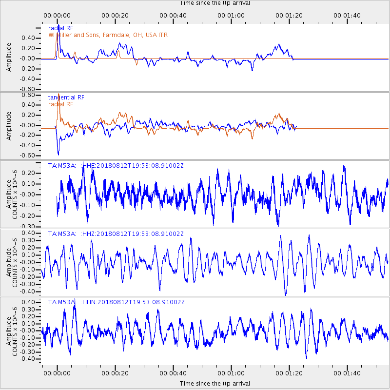
M53A WI Miller and Sons, Farmdale, OH, USA - Earthquake Result Viewer
*The percent match for this event was below the threshold and hence no stack was calculated.
| Earthquake location: |
Southeast Of Easter Island |
| Earthquake latitude/longitude: |
-35.7/-102.4 |
| Earthquake time(UTC): |
2018/08/12 (224) 19:41:34 GMT |
| Earthquake Depth: |
10 km |
| Earthquake Magnitude: |
5.6 Mww |
| Earthquake Catalog/Contributor: |
NEIC PDE/us |
|
| Network: |
TA USArray Transportable Network (new EarthScope stations) |
| Station: |
M53A WI Miller and Sons, Farmdale, OH, USA |
| Lat/Lon: |
41.44 N/80.68 W |
| Elevation: |
334 m |
|
| Distance: |
79.3 deg |
| Az: |
16.43 deg |
| Baz: |
197.833 deg |
| Ray Param: |
$rayparam |
*The percent match for this event was below the threshold and hence was not used in the summary stack. |
|
| Radial Match: |
63.656277 % |
| Radial Bump: |
400 |
| Transverse Match: |
38.117626 % |
| Transverse Bump: |
400 |
| SOD ConfigId: |
13570011 |
| Insert Time: |
2019-04-30 19:10:28.509 +0000 |
| GWidth: |
2.5 |
| Max Bumps: |
400 |
| Tol: |
0.001 |
|
Signal To Noise
| Channel | StoN | STA | LTA |
| TA:M53A: :HHZ:20180812T19:53:08.91002Z | 1.5336213 | 1.3713047E-7 | 8.9416126E-8 |
| TA:M53A: :HHN:20180812T19:53:08.91002Z | 1.937457 | 1.7451946E-7 | 9.007656E-8 |
| TA:M53A: :HHE:20180812T19:53:08.91002Z | 0.53457004 | 5.202286E-8 | 9.73172E-8 |
| Arrivals |
| Ps | |
| PpPs | |
| PsPs/PpSs | |


