Y24A Capitan, NM, USA - Earthquake Result Viewer
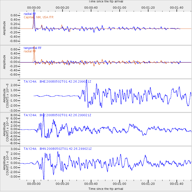
Earthquake location: Andreanof Islands, Aleutian Is.
Earthquake latitude/longitude: 51.9/-177.5
Earthquake time(UTC): 2008/05/02 (123) 01:33:37 GMT
Earthquake Depth: 14 km
Earthquake Magnitude: 6.3 MB, 6.8 MS, 6.6 MW, 6.6 MW
Earthquake Catalog/Contributor: WHDF/NEIC
Network: TA USArray Transportable Network (new EarthScope stations)
Station: Y24A Capitan, NM, USA
Lat/Lon: 33.93 N/105.44 W
Elevation: 1827 m
Distance: 53.5 deg
Az: 79.692 deg
Baz: 312.8 deg
Ray Param: 0.066027105
Estimated Moho Depth: 47.0 km
Estimated Crust Vp/Vs: 1.68
Assumed Crust Vp: 6.232 km/s
Estimated Crust Vs: 3.709 km/s
Estimated Crust Poisson's Ratio: 0.23
Radial Match: 94.92536 %
Radial Bump: 352
Transverse Match: 80.74054 %
Transverse Bump: 400
SOD ConfigId: 2504
Insert Time: 2010-03-06 13:48:31.515 +0000
GWidth: 2.5
Max Bumps: 400
Tol: 0.001

Signal To Noise

ChannelStoNSTALTA
TA:Y24A: :BHZ:20080502T01:42:26.299021Z10.2871.2415126E-61.2068753E-7
TA:Y24A: :BHN:20080502T01:42:26.299021Z3.98298744.208728E-71.0566762E-7
TA:Y24A: :BHE:20080502T01:42:26.299021Z5.78910164.3488328E-77.512103E-8
Arrivals
Ps5.4 SECOND
PpPs19 SECOND
PsPs/PpSs25 SECOND