You are here: Home > Network List > IW - Intermountain West Stations List
> Station PLID Pearl Lake, Idaho, USA > Earthquake Result Viewer
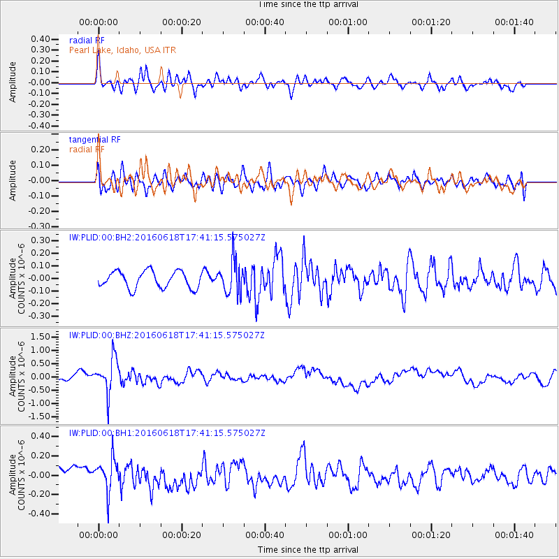
PLID Pearl Lake, Idaho, USA - Earthquake Result Viewer
*The percent match for this event was below the threshold and hence no stack was calculated.
| Earthquake location: |
Chile-Argentina Border Region |
| Earthquake latitude/longitude: |
-24.2/-67.1 |
| Earthquake time(UTC): |
2016/06/18 (170) 17:29:44 GMT |
| Earthquake Depth: |
167 km |
| Earthquake Magnitude: |
5.5 MB |
| Earthquake Catalog/Contributor: |
NEIC PDE/NEIC COMCAT |
|
| Network: |
IW Intermountain West |
| Station: |
PLID Pearl Lake, Idaho, USA |
| Lat/Lon: |
45.09 N/116.00 W |
| Elevation: |
2164 m |
|
| Distance: |
82.1 deg |
| Az: |
327.382 deg |
| Baz: |
135.992 deg |
| Ray Param: |
$rayparam |
*The percent match for this event was below the threshold and hence was not used in the summary stack. |
|
| Radial Match: |
60.305256 % |
| Radial Bump: |
400 |
| Transverse Match: |
54.631058 % |
| Transverse Bump: |
400 |
| SOD ConfigId: |
1634031 |
| Insert Time: |
2016-07-02 17:34:06.374 +0000 |
| GWidth: |
2.5 |
| Max Bumps: |
400 |
| Tol: |
0.001 |
|
Signal To Noise
| Channel | StoN | STA | LTA |
| IW:PLID:00:BHZ:20160618T17:41:15.575027Z | 6.0654325 | 6.885595E-7 | 1.1352192E-7 |
| IW:PLID:00:BH1:20160618T17:41:15.575027Z | 1.9770224 | 1.8048841E-7 | 9.129305E-8 |
| IW:PLID:00:BH2:20160618T17:41:15.575027Z | 2.0278347 | 1.3436913E-7 | 6.6262366E-8 |
| Arrivals |
| Ps | |
| PpPs | |
| PsPs/PpSs | |


