You are here: Home > Network List > TA - USArray Transportable Network (new EarthScope stations) Stations List
> Station Y24A Capitan, NM, USA > Earthquake Result Viewer
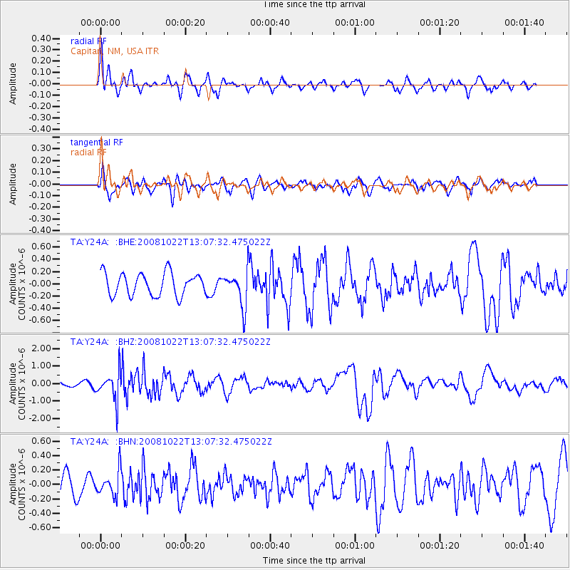
Y24A Capitan, NM, USA - Earthquake Result Viewer
*The percent match for this event was below the threshold and hence no stack was calculated.
| Earthquake location: |
Tonga Islands |
| Earthquake latitude/longitude: |
-18.4/-175.4 |
| Earthquake time(UTC): |
2008/10/22 (296) 12:55:57 GMT |
| Earthquake Depth: |
233 km |
| Earthquake Magnitude: |
5.9 MB, 6.4 MW, 6.3 MW |
| Earthquake Catalog/Contributor: |
WHDF/NEIC |
|
| Network: |
TA USArray Transportable Network (new EarthScope stations) |
| Station: |
Y24A Capitan, NM, USA |
| Lat/Lon: |
33.93 N/105.44 W |
| Elevation: |
1827 m |
|
| Distance: |
84.5 deg |
| Az: |
51.684 deg |
| Baz: |
243.623 deg |
| Ray Param: |
$rayparam |
*The percent match for this event was below the threshold and hence was not used in the summary stack. |
|
| Radial Match: |
71.69937 % |
| Radial Bump: |
332 |
| Transverse Match: |
59.42611 % |
| Transverse Bump: |
400 |
| SOD ConfigId: |
2560 |
| Insert Time: |
2010-03-06 13:49:33.297 +0000 |
| GWidth: |
2.5 |
| Max Bumps: |
400 |
| Tol: |
0.001 |
|
Signal To Noise
| Channel | StoN | STA | LTA |
| TA:Y24A: :BHZ:20081022T13:07:32.475022Z | 3.6892698 | 8.2339795E-7 | 2.2318724E-7 |
| TA:Y24A: :BHN:20081022T13:07:32.475022Z | 1.2178991 | 1.77271E-7 | 1.4555475E-7 |
| TA:Y24A: :BHE:20081022T13:07:32.475022Z | 1.6197766 | 2.9871316E-7 | 1.8441628E-7 |
| Arrivals |
| Ps | |
| PpPs | |
| PsPs/PpSs | |


