You are here: Home > Network List > TA - USArray Transportable Network (new EarthScope stations) Stations List
> Station Y24A Capitan, NM, USA > Earthquake Result Viewer
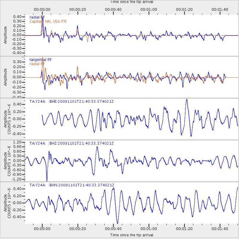
Y24A Capitan, NM, USA - Earthquake Result Viewer
*The percent match for this event was below the threshold and hence no stack was calculated.
| Earthquake location: |
Tonga Islands |
| Earthquake latitude/longitude: |
-15.5/-173.8 |
| Earthquake time(UTC): |
2009/11/01 (305) 21:28:58 GMT |
| Earthquake Depth: |
105 km |
| Earthquake Magnitude: |
5.8 MW, 5.4 MB, 5.8 MW |
| Earthquake Catalog/Contributor: |
WHDF/NEIC |
|
| Network: |
TA USArray Transportable Network (new EarthScope stations) |
| Station: |
Y24A Capitan, NM, USA |
| Lat/Lon: |
33.93 N/105.44 W |
| Elevation: |
1827 m |
|
| Distance: |
81.5 deg |
| Az: |
51.383 deg |
| Baz: |
244.946 deg |
| Ray Param: |
$rayparam |
*The percent match for this event was below the threshold and hence was not used in the summary stack. |
|
| Radial Match: |
68.98296 % |
| Radial Bump: |
400 |
| Transverse Match: |
51.114075 % |
| Transverse Bump: |
400 |
| SOD ConfigId: |
2622 |
| Insert Time: |
2010-03-06 13:50:04.582 +0000 |
| GWidth: |
2.5 |
| Max Bumps: |
400 |
| Tol: |
0.001 |
|
Signal To Noise
| Channel | StoN | STA | LTA |
| TA:Y24A: :BHZ:20091101T21:40:33.374021Z | 3.562576 | 4.4245382E-7 | 1.2419491E-7 |
| TA:Y24A: :BHN:20091101T21:40:33.374021Z | 1.0196766 | 9.7424845E-8 | 9.554485E-8 |
| TA:Y24A: :BHE:20091101T21:40:33.374021Z | 1.8507384 | 2.1407878E-7 | 1.1567209E-7 |
| Arrivals |
| Ps | |
| PpPs | |
| PsPs/PpSs | |


