You are here: Home > Network List > US - United States National Seismic Network Stations List
> Station CBKS Cedar Bluff, Kansas, USA > Earthquake Result Viewer
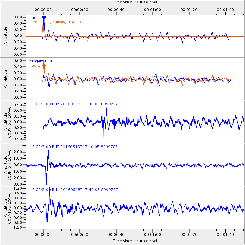
CBKS Cedar Bluff, Kansas, USA - Earthquake Result Viewer
*The percent match for this event was below the threshold and hence no stack was calculated.
| Earthquake location: |
Chile-Argentina Border Region |
| Earthquake latitude/longitude: |
-24.2/-67.1 |
| Earthquake time(UTC): |
2016/06/18 (170) 17:29:44 GMT |
| Earthquake Depth: |
167 km |
| Earthquake Magnitude: |
5.5 MB |
| Earthquake Catalog/Contributor: |
NEIC PDE/NEIC COMCAT |
|
| Network: |
US United States National Seismic Network |
| Station: |
CBKS Cedar Bluff, Kansas, USA |
| Lat/Lon: |
38.81 N/99.74 W |
| Elevation: |
677 m |
|
| Distance: |
69.8 deg |
| Az: |
333.306 deg |
| Baz: |
148.329 deg |
| Ray Param: |
$rayparam |
*The percent match for this event was below the threshold and hence was not used in the summary stack. |
|
| Radial Match: |
72.44201 % |
| Radial Bump: |
370 |
| Transverse Match: |
70.61556 % |
| Transverse Bump: |
400 |
| SOD ConfigId: |
1634031 |
| Insert Time: |
2016-07-02 17:35:30.184 +0000 |
| GWidth: |
2.5 |
| Max Bumps: |
400 |
| Tol: |
0.001 |
|
Signal To Noise
| Channel | StoN | STA | LTA |
| US:CBKS:00:BHZ:20160618T17:40:05.899978Z | 10.850957 | 9.530367E-7 | 8.782974E-8 |
| US:CBKS:00:BH1:20160618T17:40:05.899978Z | 2.9882312 | 4.7546837E-7 | 1.5911365E-7 |
| US:CBKS:00:BH2:20160618T17:40:05.899978Z | 2.9254932 | 3.3742265E-7 | 1.15338715E-7 |
| Arrivals |
| Ps | |
| PpPs | |
| PsPs/PpSs | |


