U21A Nageezi, NM, USA - Earthquake Result Viewer
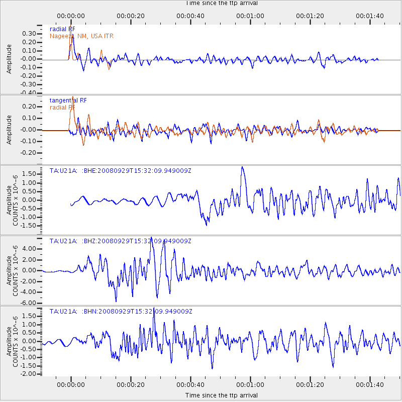
Earthquake location: Kermadec Islands, New Zealand
Earthquake latitude/longitude: -29.8/-177.7
Earthquake time(UTC): 2008/09/29 (273) 15:19:31 GMT
Earthquake Depth: 36 km
Earthquake Magnitude: 6.5 MB, 6.7 MS, 7.0 MW, 7.0 MW
Earthquake Catalog/Contributor: WHDF/NEIC
Network: TA USArray Transportable Network (new EarthScope stations)
Station: U21A Nageezi, NM, USA
Lat/Lon: 36.43 N/107.66 W
Elevation: 2124 m
Distance: 93.0 deg
Az: 49.379 deg
Baz: 234.924 deg
Ray Param: 0.041334398
Estimated Moho Depth: 39.0 km
Estimated Crust Vp/Vs: 1.90
Assumed Crust Vp: 6.159 km/s
Estimated Crust Vs: 3.237 km/s
Estimated Crust Poisson's Ratio: 0.31
Radial Match: 90.40351 %
Radial Bump: 400
Transverse Match: 84.50206 %
Transverse Bump: 400
SOD ConfigId: 2560
Insert Time: 2010-03-06 13:51:21.333 +0000
GWidth: 2.5
Max Bumps: 400
Tol: 0.001

Signal To Noise

ChannelStoNSTALTA
TA:U21A: :BHZ:20080929T15:32:09.949009Z4.45103034.7257356E-71.06171726E-7
TA:U21A: :BHN:20080929T15:32:09.949009Z1.07660571.6512759E-71.5337797E-7
TA:U21A: :BHE:20080929T15:32:09.949009Z2.15282852.6173606E-71.2157776E-7
Arrivals
Ps5.8 SECOND
PpPs18 SECOND
PsPs/PpSs24 SECOND