You are here: Home > Network List > US - United States National Seismic Network Stations List
> Station HAWA Hanford, Washington, USA > Earthquake Result Viewer
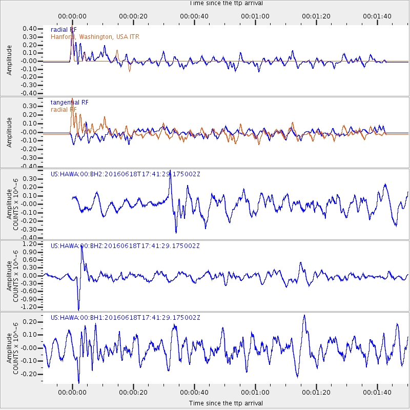
HAWA Hanford, Washington, USA - Earthquake Result Viewer
*The percent match for this event was below the threshold and hence no stack was calculated.
| Earthquake location: |
Chile-Argentina Border Region |
| Earthquake latitude/longitude: |
-24.2/-67.1 |
| Earthquake time(UTC): |
2016/06/18 (170) 17:29:44 GMT |
| Earthquake Depth: |
167 km |
| Earthquake Magnitude: |
5.5 MB |
| Earthquake Catalog/Contributor: |
NEIC PDE/NEIC COMCAT |
|
| Network: |
US United States National Seismic Network |
| Station: |
HAWA Hanford, Washington, USA |
| Lat/Lon: |
46.39 N/119.53 W |
| Elevation: |
364 m |
|
| Distance: |
84.8 deg |
| Az: |
326.565 deg |
| Baz: |
133.377 deg |
| Ray Param: |
$rayparam |
*The percent match for this event was below the threshold and hence was not used in the summary stack. |
|
| Radial Match: |
69.317764 % |
| Radial Bump: |
400 |
| Transverse Match: |
45.532898 % |
| Transverse Bump: |
400 |
| SOD ConfigId: |
1634031 |
| Insert Time: |
2016-07-02 17:35:54.893 +0000 |
| GWidth: |
2.5 |
| Max Bumps: |
400 |
| Tol: |
0.001 |
|
Signal To Noise
| Channel | StoN | STA | LTA |
| US:HAWA:00:BHZ:20160618T17:41:29.175002Z | 7.9569416 | 5.53026E-7 | 6.950233E-8 |
| US:HAWA:00:BH1:20160618T17:41:29.175002Z | 1.2442465 | 1.12900594E-7 | 9.073812E-8 |
| US:HAWA:00:BH2:20160618T17:41:29.175002Z | 2.6475642 | 1.6264626E-7 | 6.143242E-8 |
| Arrivals |
| Ps | |
| PpPs | |
| PsPs/PpSs | |


