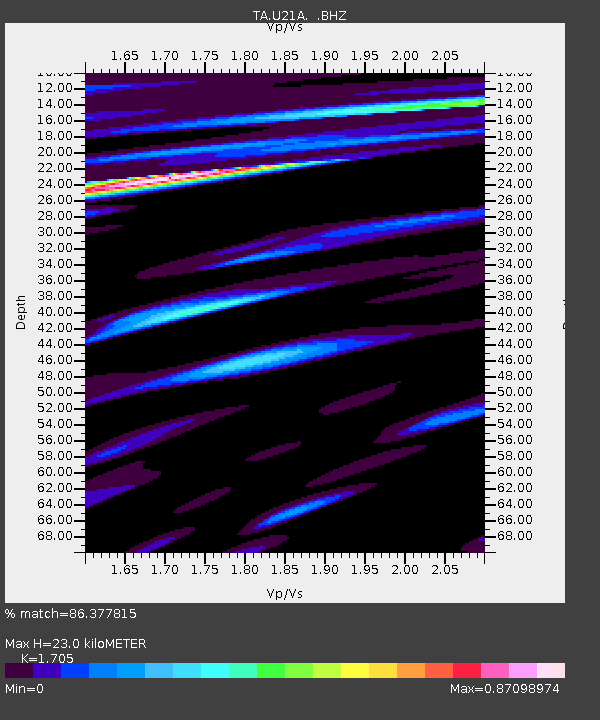
U21A Nageezi, NM, USA - Earthquake Result Viewer
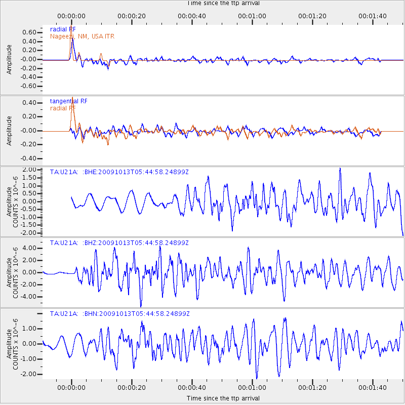
Earthquake location: Fox Islands, Aleutian Islands
Earthquake latitude/longitude: 52.8/-167.0
Earthquake time(UTC): 2009/10/13 (286) 05:37:23 GMT
Earthquake Depth: 24 km
Earthquake Magnitude: 6.0 MB, 6.1 MS, 6.5 MW, 6.5 MW
Earthquake Catalog/Contributor: WHDF/NEIC
Network: TA USArray Transportable Network (new EarthScope stations)
Station: U21A Nageezi, NM, USA
Lat/Lon: 36.43 N/107.66 W
Elevation: 2124 m
Distance: 44.0 deg
Az: 87.296 deg
Baz: 311.167 deg
Ray Param: 0.07215489
Estimated Moho Depth: 23.0 km
Estimated Crust Vp/Vs: 1.71
Assumed Crust Vp: 6.159 km/s
Estimated Crust Vs: 3.612 km/s
Estimated Crust Poisson's Ratio: 0.24
Radial Match: 86.377815 %
Radial Bump: 400
Transverse Match: 67.77422 %
Transverse Bump: 400
SOD ConfigId: 2622
Insert Time: 2010-03-06 13:51:51.953 +0000
GWidth: 2.5
Max Bumps: 400
Tol: 0.001

Signal To Noise

ChannelStoNSTALTA
TA:U21A: :BHZ:20091013T05:44:58.24899Z2.27126247.211954E-73.1753063E-7
TA:U21A: :BHN:20091013T05:44:58.24899Z2.79001055.858983E-72.0999862E-7
TA:U21A: :BHE:20091013T05:44:58.24899Z0.59982232.3089838E-73.8494466E-7
Arrivals
Ps2.8 SECOND
PpPs9.5 SECOND
PsPs/PpSs12 SECOND