You are here: Home > Network List > TA - USArray Transportable Network (new EarthScope stations) Stations List
> Station U21A Nageezi, NM, USA > Earthquake Result Viewer
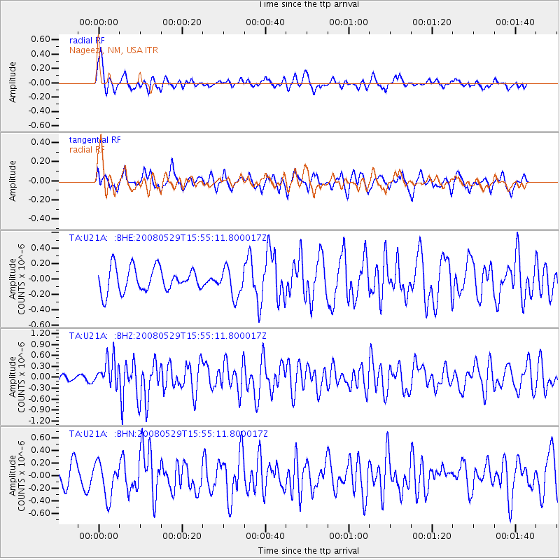
U21A Nageezi, NM, USA - Earthquake Result Viewer
*The percent match for this event was below the threshold and hence no stack was calculated.
| Earthquake location: |
Iceland |
| Earthquake latitude/longitude: |
64.0/-21.0 |
| Earthquake time(UTC): |
2008/05/29 (150) 15:46:00 GMT |
| Earthquake Depth: |
10 km |
| Earthquake Magnitude: |
6.0 MB, 6.2 MS, 6.3 MW, 6.2 MW |
| Earthquake Catalog/Contributor: |
WHDF/NEIC |
|
| Network: |
TA USArray Transportable Network (new EarthScope stations) |
| Station: |
U21A Nageezi, NM, USA |
| Lat/Lon: |
36.43 N/107.66 W |
| Elevation: |
2124 m |
|
| Distance: |
56.5 deg |
| Az: |
285.163 deg |
| Baz: |
31.83 deg |
| Ray Param: |
$rayparam |
*The percent match for this event was below the threshold and hence was not used in the summary stack. |
|
| Radial Match: |
62.769356 % |
| Radial Bump: |
400 |
| Transverse Match: |
61.49491 % |
| Transverse Bump: |
400 |
| SOD ConfigId: |
2504 |
| Insert Time: |
2010-03-06 13:52:35.991 +0000 |
| GWidth: |
2.5 |
| Max Bumps: |
400 |
| Tol: |
0.001 |
|
Signal To Noise
| Channel | StoN | STA | LTA |
| TA:U21A: :BHZ:20080529T15:55:11.800017Z | 2.5301769 | 3.87277E-7 | 1.5306321E-7 |
| TA:U21A: :BHN:20080529T15:55:11.800017Z | 1.8066779 | 2.7985297E-7 | 1.548992E-7 |
| TA:U21A: :BHE:20080529T15:55:11.800017Z | 1.2155063 | 1.8754702E-7 | 1.5429539E-7 |
| Arrivals |
| Ps | |
| PpPs | |
| PsPs/PpSs | |


