You are here: Home > Network List > TA - USArray Transportable Network (new EarthScope stations) Stations List
> Station U21A Nageezi, NM, USA > Earthquake Result Viewer
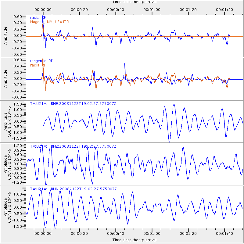
U21A Nageezi, NM, USA - Earthquake Result Viewer
*The percent match for this event was below the threshold and hence no stack was calculated.
| Earthquake location: |
North Of Ascension Island |
| Earthquake latitude/longitude: |
-1.2/-13.9 |
| Earthquake time(UTC): |
2008/11/22 (327) 18:49:42 GMT |
| Earthquake Depth: |
10 km |
| Earthquake Magnitude: |
5.9 MB, 6.0 MS, 6.3 MW, 6.2 MW |
| Earthquake Catalog/Contributor: |
WHDF/NEIC |
|
| Network: |
TA USArray Transportable Network (new EarthScope stations) |
| Station: |
U21A Nageezi, NM, USA |
| Lat/Lon: |
36.43 N/107.66 W |
| Elevation: |
2124 m |
|
| Distance: |
93.7 deg |
| Az: |
306.244 deg |
| Baz: |
88.782 deg |
| Ray Param: |
$rayparam |
*The percent match for this event was below the threshold and hence was not used in the summary stack. |
|
| Radial Match: |
62.921555 % |
| Radial Bump: |
400 |
| Transverse Match: |
52.716747 % |
| Transverse Bump: |
330 |
| SOD ConfigId: |
2658 |
| Insert Time: |
2010-03-06 13:53:15.569 +0000 |
| GWidth: |
2.5 |
| Max Bumps: |
400 |
| Tol: |
0.001 |
|
Signal To Noise
| Channel | StoN | STA | LTA |
| TA:U21A: :BHZ:20081122T19:02:27.575007Z | 1.3407782 | 9.5129275E-7 | 7.095079E-7 |
| TA:U21A: :BHN:20081122T19:02:27.575007Z | 2.1855729 | 1.024671E-6 | 4.6883403E-7 |
| TA:U21A: :BHE:20081122T19:02:27.575007Z | 1.4726974 | 6.418127E-7 | 4.3580758E-7 |
| Arrivals |
| Ps | |
| PpPs | |
| PsPs/PpSs | |


