You are here: Home > Network List > TA - USArray Transportable Network (new EarthScope stations) Stations List
> Station U21A Nageezi, NM, USA > Earthquake Result Viewer
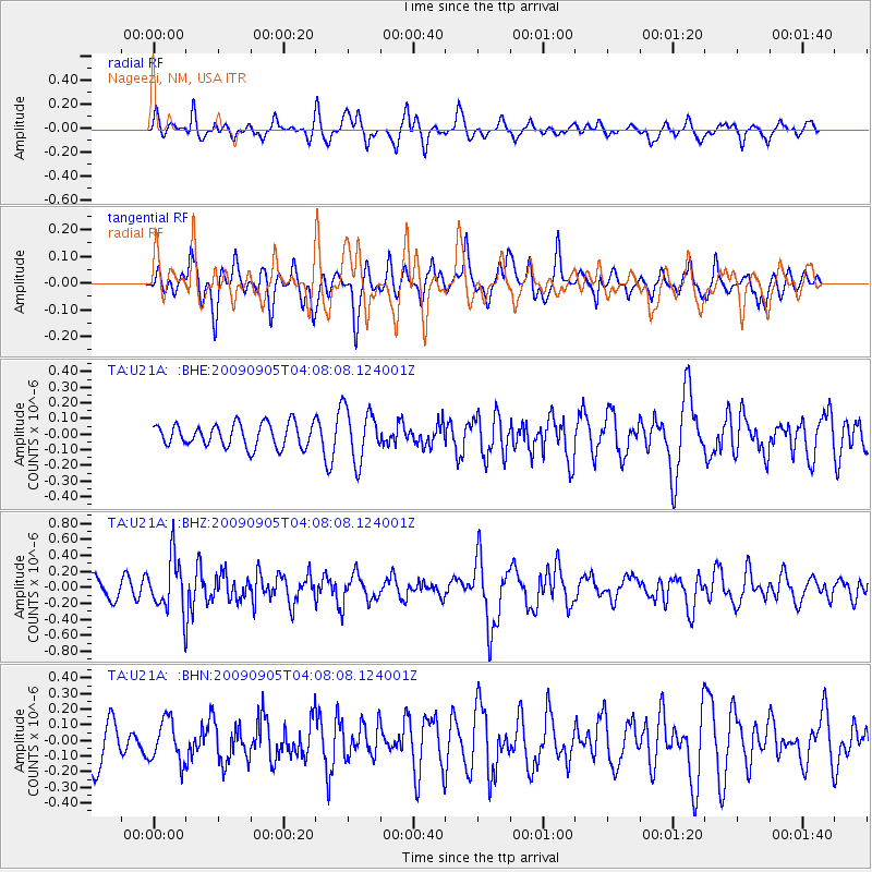
U21A Nageezi, NM, USA - Earthquake Result Viewer
*The percent match for this event was below the threshold and hence no stack was calculated.
| Earthquake location: |
Southern Peru |
| Earthquake latitude/longitude: |
-15.1/-70.2 |
| Earthquake time(UTC): |
2009/09/05 (248) 03:58:39 GMT |
| Earthquake Depth: |
210 km |
| Earthquake Magnitude: |
5.8 MW, 5.2 MB, 5.8 MW |
| Earthquake Catalog/Contributor: |
WHDF/NEIC |
|
| Network: |
TA USArray Transportable Network (new EarthScope stations) |
| Station: |
U21A Nageezi, NM, USA |
| Lat/Lon: |
36.43 N/107.66 W |
| Elevation: |
2124 m |
|
| Distance: |
62.3 deg |
| Az: |
326.387 deg |
| Baz: |
138.476 deg |
| Ray Param: |
$rayparam |
*The percent match for this event was below the threshold and hence was not used in the summary stack. |
|
| Radial Match: |
54.847874 % |
| Radial Bump: |
388 |
| Transverse Match: |
65.108185 % |
| Transverse Bump: |
400 |
| SOD ConfigId: |
2622 |
| Insert Time: |
2010-03-06 13:53:31.130 +0000 |
| GWidth: |
2.5 |
| Max Bumps: |
400 |
| Tol: |
0.001 |
|
Signal To Noise
| Channel | StoN | STA | LTA |
| TA:U21A: :BHZ:20090905T04:08:08.124001Z | 3.1363049 | 3.2883804E-7 | 1.0484887E-7 |
| TA:U21A: :BHN:20090905T04:08:08.124001Z | 1.0913745 | 1.3387388E-7 | 1.2266538E-7 |
| TA:U21A: :BHE:20090905T04:08:08.124001Z | 2.2773533 | 1.6757885E-7 | 7.3584914E-8 |
| Arrivals |
| Ps | |
| PpPs | |
| PsPs/PpSs | |


