You are here: Home > Network List > TA - USArray Transportable Network (new EarthScope stations) Stations List
> Station U21A Nageezi, NM, USA > Earthquake Result Viewer
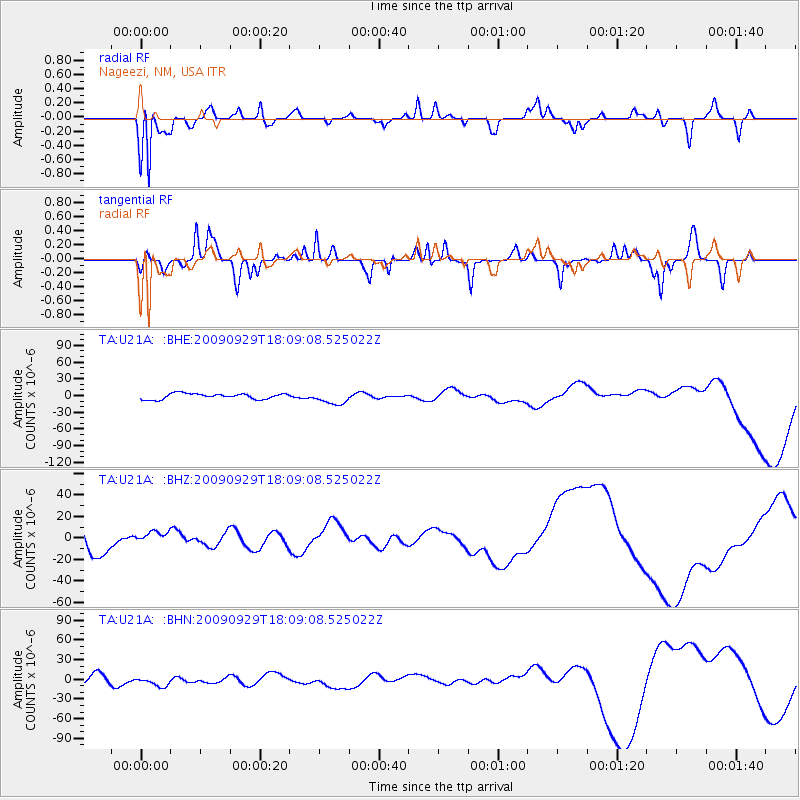
U21A Nageezi, NM, USA - Earthquake Result Viewer
*The percent match for this event was below the threshold and hence no stack was calculated.
| Earthquake location: |
Tonga Islands |
| Earthquake latitude/longitude: |
-15.8/-173.1 |
| Earthquake time(UTC): |
2009/09/29 (272) 17:57:26 GMT |
| Earthquake Depth: |
10 km |
| Earthquake Magnitude: |
5.6 MB |
| Earthquake Catalog/Contributor: |
WHDF/NEIC |
|
| Network: |
TA USArray Transportable Network (new EarthScope stations) |
| Station: |
U21A Nageezi, NM, USA |
| Lat/Lon: |
36.43 N/107.66 W |
| Elevation: |
2124 m |
|
| Distance: |
80.7 deg |
| Az: |
48.035 deg |
| Baz: |
242.557 deg |
| Ray Param: |
$rayparam |
*The percent match for this event was below the threshold and hence was not used in the summary stack. |
|
| Radial Match: |
92.30791 % |
| Radial Bump: |
277 |
| Transverse Match: |
70.1876 % |
| Transverse Bump: |
328 |
| SOD ConfigId: |
2622 |
| Insert Time: |
2010-03-06 13:53:36.708 +0000 |
| GWidth: |
2.5 |
| Max Bumps: |
400 |
| Tol: |
0.001 |
|
Signal To Noise
| Channel | StoN | STA | LTA |
| TA:U21A: :BHZ:20090929T18:09:08.525022Z | 0.52407247 | 5.451444E-6 | 1.0402081E-5 |
| TA:U21A: :BHN:20090929T18:09:08.525022Z | 1.0706943 | 7.3060482E-6 | 6.8236545E-6 |
| TA:U21A: :BHE:20090929T18:09:08.525022Z | 2.2892382 | 1.14256945E-5 | 4.991047E-6 |
| Arrivals |
| Ps | |
| PpPs | |
| PsPs/PpSs | |


