You are here: Home > Network List > TA - USArray Transportable Network (new EarthScope stations) Stations List
> Station U21A Nageezi, NM, USA > Earthquake Result Viewer
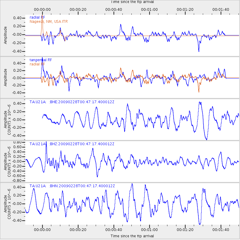
U21A Nageezi, NM, USA - Earthquake Result Viewer
*The percent match for this event was below the threshold and hence no stack was calculated.
| Earthquake location: |
Hokkaido, Japan Region |
| Earthquake latitude/longitude: |
42.6/142.1 |
| Earthquake time(UTC): |
2009/02/28 (059) 00:35:56 GMT |
| Earthquake Depth: |
105 km |
| Earthquake Magnitude: |
5.5 MB, 5.5 MW, 5.5 MW |
| Earthquake Catalog/Contributor: |
WHDF/NEIC |
|
| Network: |
TA USArray Transportable Network (new EarthScope stations) |
| Station: |
U21A Nageezi, NM, USA |
| Lat/Lon: |
36.43 N/107.66 W |
| Elevation: |
2124 m |
|
| Distance: |
78.9 deg |
| Az: |
50.461 deg |
| Baz: |
315.097 deg |
| Ray Param: |
$rayparam |
*The percent match for this event was below the threshold and hence was not used in the summary stack. |
|
| Radial Match: |
59.836018 % |
| Radial Bump: |
400 |
| Transverse Match: |
72.224754 % |
| Transverse Bump: |
400 |
| SOD ConfigId: |
2658 |
| Insert Time: |
2010-03-06 13:54:08.368 +0000 |
| GWidth: |
2.5 |
| Max Bumps: |
400 |
| Tol: |
0.001 |
|
Signal To Noise
| Channel | StoN | STA | LTA |
| TA:U21A: :BHZ:20090228T00:47:17.400012Z | 2.8499556 | 3.0778253E-7 | 1.07995554E-7 |
| TA:U21A: :BHN:20090228T00:47:17.400012Z | 1.0066594 | 1.8184627E-7 | 1.806433E-7 |
| TA:U21A: :BHE:20090228T00:47:17.400012Z | 1.7547172 | 1.8384897E-7 | 1.04774124E-7 |
| Arrivals |
| Ps | |
| PpPs | |
| PsPs/PpSs | |


