You are here: Home > Network List > TA - USArray Transportable Network (new EarthScope stations) Stations List
> Station U21A Nageezi, NM, USA > Earthquake Result Viewer
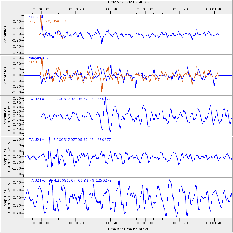
U21A Nageezi, NM, USA - Earthquake Result Viewer
*The percent match for this event was below the threshold and hence no stack was calculated.
| Earthquake location: |
Northern Mid-Atlantic Ridge |
| Earthquake latitude/longitude: |
13.4/-44.8 |
| Earthquake time(UTC): |
2008/12/07 (342) 06:23:09 GMT |
| Earthquake Depth: |
10 km |
| Earthquake Magnitude: |
5.6 MB, 5.3 MS, 5.7 MW |
| Earthquake Catalog/Contributor: |
WHDF/NEIC |
|
| Network: |
TA USArray Transportable Network (new EarthScope stations) |
| Station: |
U21A Nageezi, NM, USA |
| Lat/Lon: |
36.43 N/107.66 W |
| Elevation: |
2124 m |
|
| Distance: |
60.4 deg |
| Az: |
304.382 deg |
| Baz: |
95.128 deg |
| Ray Param: |
$rayparam |
*The percent match for this event was below the threshold and hence was not used in the summary stack. |
|
| Radial Match: |
60.874332 % |
| Radial Bump: |
372 |
| Transverse Match: |
51.74033 % |
| Transverse Bump: |
335 |
| SOD ConfigId: |
2658 |
| Insert Time: |
2010-03-06 13:54:17.040 +0000 |
| GWidth: |
2.5 |
| Max Bumps: |
400 |
| Tol: |
0.001 |
|
Signal To Noise
| Channel | StoN | STA | LTA |
| TA:U21A: :BHZ:20081207T06:32:48.125027Z | 3.8591442 | 5.3941807E-7 | 1.397766E-7 |
| TA:U21A: :BHN:20081207T06:32:48.125027Z | 1.4275969 | 2.645715E-7 | 1.8532646E-7 |
| TA:U21A: :BHE:20081207T06:32:48.125027Z | 1.6336886 | 1.666589E-7 | 1.0201388E-7 |
| Arrivals |
| Ps | |
| PpPs | |
| PsPs/PpSs | |


