You are here: Home > Network List > TA - USArray Transportable Network (new EarthScope stations) Stations List
> Station U21A Nageezi, NM, USA > Earthquake Result Viewer
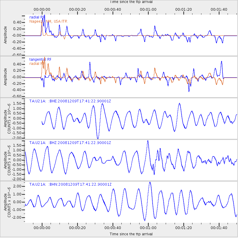
U21A Nageezi, NM, USA - Earthquake Result Viewer
*The percent match for this event was below the threshold and hence no stack was calculated.
| Earthquake location: |
Vanuatu Islands |
| Earthquake latitude/longitude: |
-15.9/168.2 |
| Earthquake time(UTC): |
2008/12/09 (344) 17:28:58 GMT |
| Earthquake Depth: |
224 km |
| Earthquake Magnitude: |
5.5 MB, 6.0 MW, 6.0 MW |
| Earthquake Catalog/Contributor: |
WHDF/NEIC |
|
| Network: |
TA USArray Transportable Network (new EarthScope stations) |
| Station: |
U21A Nageezi, NM, USA |
| Lat/Lon: |
36.43 N/107.66 W |
| Elevation: |
2124 m |
|
| Distance: |
94.7 deg |
| Az: |
53.617 deg |
| Baz: |
253.817 deg |
| Ray Param: |
$rayparam |
*The percent match for this event was below the threshold and hence was not used in the summary stack. |
|
| Radial Match: |
65.54884 % |
| Radial Bump: |
400 |
| Transverse Match: |
48.534676 % |
| Transverse Bump: |
365 |
| SOD ConfigId: |
2658 |
| Insert Time: |
2010-03-06 13:54:22.477 +0000 |
| GWidth: |
2.5 |
| Max Bumps: |
400 |
| Tol: |
0.001 |
|
Signal To Noise
| Channel | StoN | STA | LTA |
| TA:U21A: :BHZ:20081209T17:41:22.90001Z | 1.411169 | 9.50466E-7 | 6.735309E-7 |
| TA:U21A: :BHN:20081209T17:41:22.90001Z | 0.53143483 | 3.9845858E-7 | 7.497788E-7 |
| TA:U21A: :BHE:20081209T17:41:22.90001Z | 2.3783755 | 1.293468E-6 | 5.438451E-7 |
| Arrivals |
| Ps | |
| PpPs | |
| PsPs/PpSs | |


