You are here: Home > Network List > TA - USArray Transportable Network (new EarthScope stations) Stations List
> Station U21A Nageezi, NM, USA > Earthquake Result Viewer
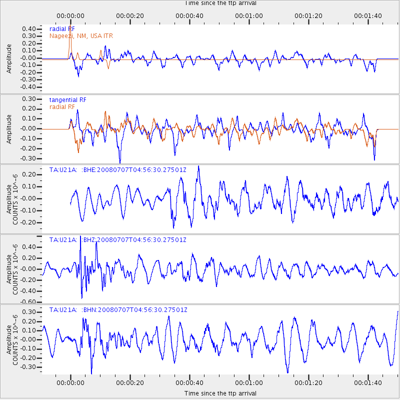
U21A Nageezi, NM, USA - Earthquake Result Viewer
*The percent match for this event was below the threshold and hence no stack was calculated.
| Earthquake location: |
Tonga Islands |
| Earthquake latitude/longitude: |
-16.4/-174.0 |
| Earthquake time(UTC): |
2008/07/07 (189) 04:44:55 GMT |
| Earthquake Depth: |
116 km |
| Earthquake Magnitude: |
5.5 MW, 5.0 MB, 5.5 MW |
| Earthquake Catalog/Contributor: |
WHDF/NEIC |
|
| Network: |
TA USArray Transportable Network (new EarthScope stations) |
| Station: |
U21A Nageezi, NM, USA |
| Lat/Lon: |
36.43 N/107.66 W |
| Elevation: |
2124 m |
|
| Distance: |
81.7 deg |
| Az: |
48.31 deg |
| Baz: |
242.696 deg |
| Ray Param: |
$rayparam |
*The percent match for this event was below the threshold and hence was not used in the summary stack. |
|
| Radial Match: |
58.555183 % |
| Radial Bump: |
400 |
| Transverse Match: |
51.334927 % |
| Transverse Bump: |
375 |
| SOD ConfigId: |
2504 |
| Insert Time: |
2010-03-06 13:54:51.559 +0000 |
| GWidth: |
2.5 |
| Max Bumps: |
400 |
| Tol: |
0.001 |
|
Signal To Noise
| Channel | StoN | STA | LTA |
| TA:U21A: :BHZ:20080707T04:56:30.27501Z | 1.8487594 | 1.925572E-7 | 1.0415482E-7 |
| TA:U21A: :BHN:20080707T04:56:30.27501Z | 1.0090141 | 9.200316E-8 | 9.118124E-8 |
| TA:U21A: :BHE:20080707T04:56:30.27501Z | 1.1087668 | 8.386377E-8 | 7.5636976E-8 |
| Arrivals |
| Ps | |
| PpPs | |
| PsPs/PpSs | |


