You are here: Home > Network List > TA - USArray Transportable Network (new EarthScope stations) Stations List
> Station U21A Nageezi, NM, USA > Earthquake Result Viewer
U21A Nageezi, NM, USA - Earthquake Result Viewer
*The percent match for this event was below the threshold and hence no stack was calculated.
| Earthquake location: |
Vanuatu Islands |
| Earthquake latitude/longitude: |
-20.0/169.1 |
| Earthquake time(UTC): |
2008/09/08 (252) 03:03:15 GMT |
| Earthquake Depth: |
36 km |
| Earthquake Magnitude: |
6.0 MB, 5.8 MS, 6.2 MW, 6.2 MW |
| Earthquake Catalog/Contributor: |
WHDF/NEIC |
|
| Network: |
TA USArray Transportable Network (new EarthScope stations) |
| Station: |
U21A Nageezi, NM, USA |
| Lat/Lon: |
36.43 N/107.66 W |
| Elevation: |
2124 m |
|
| Distance: |
96.4 deg |
| Az: |
53.697 deg |
| Baz: |
250.039 deg |
| Ray Param: |
$rayparam |
*The percent match for this event was below the threshold and hence was not used in the summary stack. |
|
| Radial Match: |
58.42256 % |
| Radial Bump: |
383 |
| Transverse Match: |
64.521576 % |
| Transverse Bump: |
357 |
| SOD ConfigId: |
2560 |
| Insert Time: |
2010-03-06 13:55:12.492 +0000 |
| GWidth: |
2.5 |
| Max Bumps: |
400 |
| Tol: |
0.001 |
|
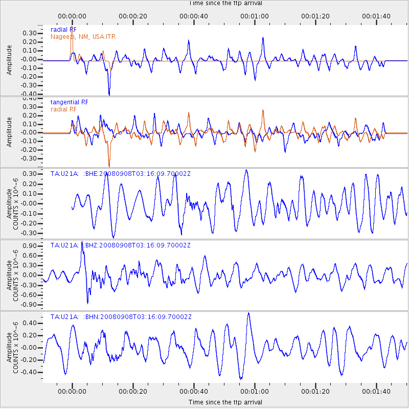
Signal To Noise
| Channel | StoN | STA | LTA |
| TA:U21A: :BHZ:20080908T03:16:09.70002Z | 2.771798 | 3.958607E-7 | 1.428173E-7 |
| TA:U21A: :BHN:20080908T03:16:09.70002Z | 0.9714693 | 1.9478365E-7 | 2.0050418E-7 |
| TA:U21A: :BHE:20080908T03:16:09.70002Z | 1.004621 | 1.3908905E-7 | 1.3844928E-7 |
| Arrivals |
| Ps | |
| PpPs | |
| PsPs/PpSs | |


