You are here: Home > Network List > TA - USArray Transportable Network (new EarthScope stations) Stations List
> Station U21A Nageezi, NM, USA > Earthquake Result Viewer
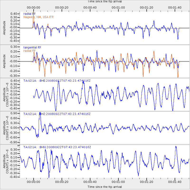
U21A Nageezi, NM, USA - Earthquake Result Viewer
*The percent match for this event was below the threshold and hence no stack was calculated.
| Earthquake location: |
Hokkaido, Japan Region |
| Earthquake latitude/longitude: |
41.6/140.4 |
| Earthquake time(UTC): |
2008/09/22 (266) 07:31:59 GMT |
| Earthquake Depth: |
149 km |
| Earthquake Magnitude: |
5.7 MW, 5.3 MB, 5.6 MW |
| Earthquake Catalog/Contributor: |
WHDF/NEIC |
|
| Network: |
TA USArray Transportable Network (new EarthScope stations) |
| Station: |
U21A Nageezi, NM, USA |
| Lat/Lon: |
36.43 N/107.66 W |
| Elevation: |
2124 m |
|
| Distance: |
80.5 deg |
| Az: |
49.357 deg |
| Baz: |
315.101 deg |
| Ray Param: |
$rayparam |
*The percent match for this event was below the threshold and hence was not used in the summary stack. |
|
| Radial Match: |
51.835274 % |
| Radial Bump: |
357 |
| Transverse Match: |
67.94231 % |
| Transverse Bump: |
400 |
| SOD ConfigId: |
2560 |
| Insert Time: |
2010-03-06 13:55:18.993 +0000 |
| GWidth: |
2.5 |
| Max Bumps: |
400 |
| Tol: |
0.001 |
|
Signal To Noise
| Channel | StoN | STA | LTA |
| TA:U21A: :BHZ:20080922T07:43:23.474016Z | 5.263584 | 4.509033E-7 | 8.566469E-8 |
| TA:U21A: :BHN:20080922T07:43:23.474016Z | 1.4443479 | 1.7221073E-7 | 1.1923079E-7 |
| TA:U21A: :BHE:20080922T07:43:23.474016Z | 0.9271634 | 1.4741259E-7 | 1.5899312E-7 |
| Arrivals |
| Ps | |
| PpPs | |
| PsPs/PpSs | |


