You are here: Home > Network List > UW - Pacific Northwest Regional Seismic Network Stations List
> Station LEBA Lebam, WA, USA > Earthquake Result Viewer
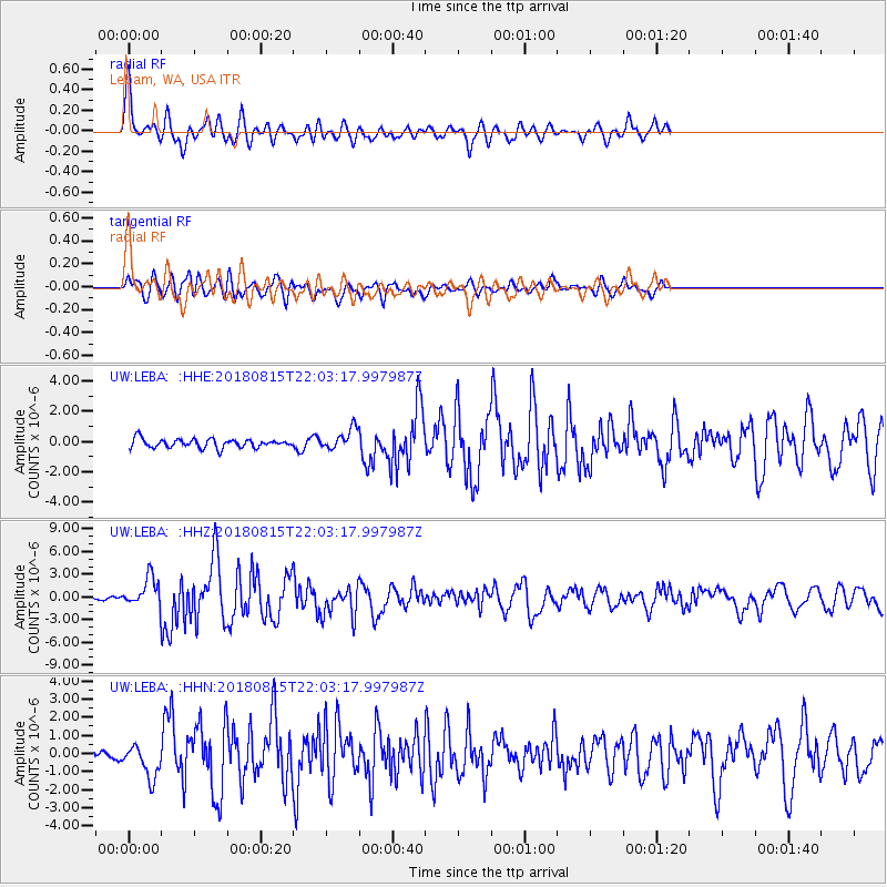
LEBA Lebam, WA, USA - Earthquake Result Viewer
*The percent match for this event was below the threshold and hence no stack was calculated.
| Earthquake location: |
Andreanof Islands, Aleutian Is. |
| Earthquake latitude/longitude: |
51.4/-178.1 |
| Earthquake time(UTC): |
2018/08/15 (227) 21:56:54 GMT |
| Earthquake Depth: |
20 km |
| Earthquake Magnitude: |
6.6 Mww |
| Earthquake Catalog/Contributor: |
NEIC PDE/us |
|
| Network: |
UW Pacific Northwest Regional Seismic Network |
| Station: |
LEBA Lebam, WA, USA |
| Lat/Lon: |
46.55 N/123.56 W |
| Elevation: |
73 m |
|
| Distance: |
35.4 deg |
| Az: |
75.978 deg |
| Baz: |
298.37 deg |
| Ray Param: |
$rayparam |
*The percent match for this event was below the threshold and hence was not used in the summary stack. |
|
| Radial Match: |
78.441696 % |
| Radial Bump: |
400 |
| Transverse Match: |
75.8626 % |
| Transverse Bump: |
400 |
| SOD ConfigId: |
13570011 |
| Insert Time: |
2019-04-30 19:41:12.200 +0000 |
| GWidth: |
2.5 |
| Max Bumps: |
400 |
| Tol: |
0.001 |
|
Signal To Noise
| Channel | StoN | STA | LTA |
| UW:LEBA: :HHZ:20180815T22:03:17.997987Z | 10.483922 | 2.0744733E-6 | 1.9787188E-7 |
| UW:LEBA: :HHN:20180815T22:03:17.997987Z | 3.552199 | 9.1456036E-7 | 2.5746317E-7 |
| UW:LEBA: :HHE:20180815T22:03:17.997987Z | 2.5315766 | 7.266092E-7 | 2.8701845E-7 |
| Arrivals |
| Ps | |
| PpPs | |
| PsPs/PpSs | |


