You are here: Home > Network List > TA - USArray Transportable Network (new EarthScope stations) Stations List
> Station S24A Houchin Ranch, La Veta, CO, USA > Earthquake Result Viewer
S24A Houchin Ranch, La Veta, CO, USA - Earthquake Result Viewer

| Earthquake location: |
Easter Island Region |
| Earthquake latitude/longitude: |
-28.5/-112.8 |
| Earthquake time(UTC): |
2008/08/19 (232) 10:58:00 GMT |
| Earthquake Depth: |
9.0 km |
| Earthquake Magnitude: |
5.5 MB, 5.3 MS, 5.7 MW, 5.7 MW |
| Earthquake Catalog/Contributor: |
WHDF/NEIC |
|
| Network: |
TA USArray Transportable Network (new EarthScope stations) |
| Station: |
S24A Houchin Ranch, La Veta, CO, USA |
| Lat/Lon: |
37.64 N/105.21 W |
| Elevation: |
2672 m |
|
| Distance: |
66.2 deg |
| Az: |
6.613 deg |
| Baz: |
187.333 deg |
| Ray Param: |
0.05775707 |
| Estimated Moho Depth: |
16.25 km |
| Estimated Crust Vp/Vs: |
1.97 |
| Assumed Crust Vp: |
6.316 km/s |
| Estimated Crust Vs: |
3.206 km/s |
| Estimated Crust Poisson's Ratio: |
0.33 |
|
| Radial Match: |
85.643845 % |
| Radial Bump: |
382 |
| Transverse Match: |
63.085457 % |
| Transverse Bump: |
315 |
| SOD ConfigId: |
2504 |
| Insert Time: |
2010-03-06 13:55:42.981 +0000 |
| GWidth: |
2.5 |
| Max Bumps: |
400 |
| Tol: |
0.001 |
|
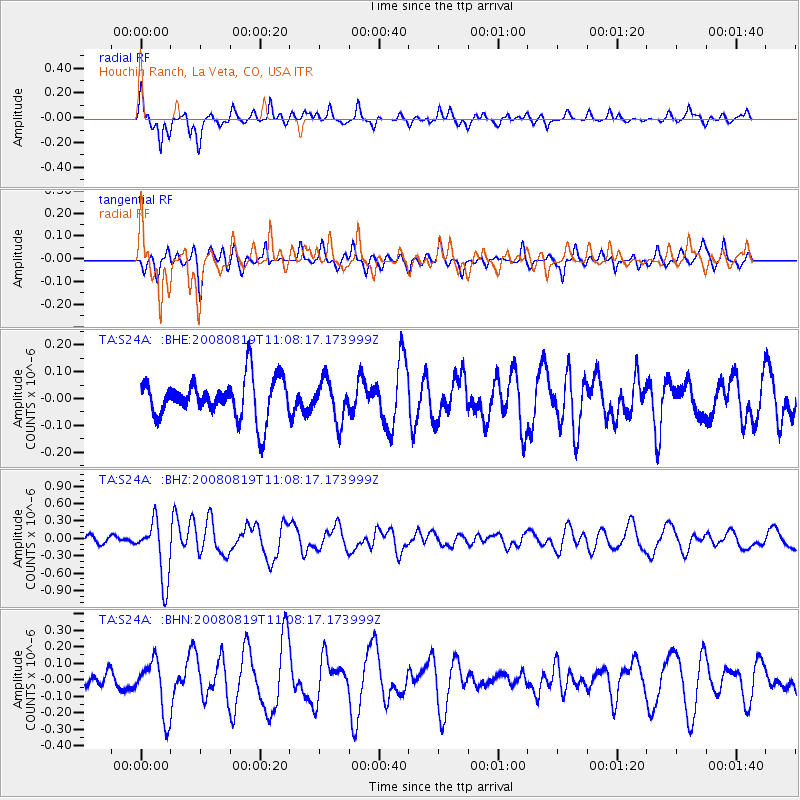
Signal To Noise
| Channel | StoN | STA | LTA |
| TA:S24A: :BHZ:20080819T11:08:17.173999Z | 6.6003113 | 5.087987E-7 | 7.708708E-8 |
| TA:S24A: :BHN:20080819T11:08:17.173999Z | 3.7166698 | 1.6627033E-7 | 4.4736375E-8 |
| TA:S24A: :BHE:20080819T11:08:17.173999Z | 1.0209181 | 7.5539575E-8 | 7.399181E-8 |
| Arrivals |
| Ps | 2.6 SECOND |
| PpPs | 7.4 SECOND |
| PsPs/PpSs | 10.0 SECOND |


