You are here: Home > Network List > II - Global Seismograph Network (GSN - IRIS/IDA) Stations List
> Station WRAB Tennant Creek, NT, Australia > Earthquake Result Viewer
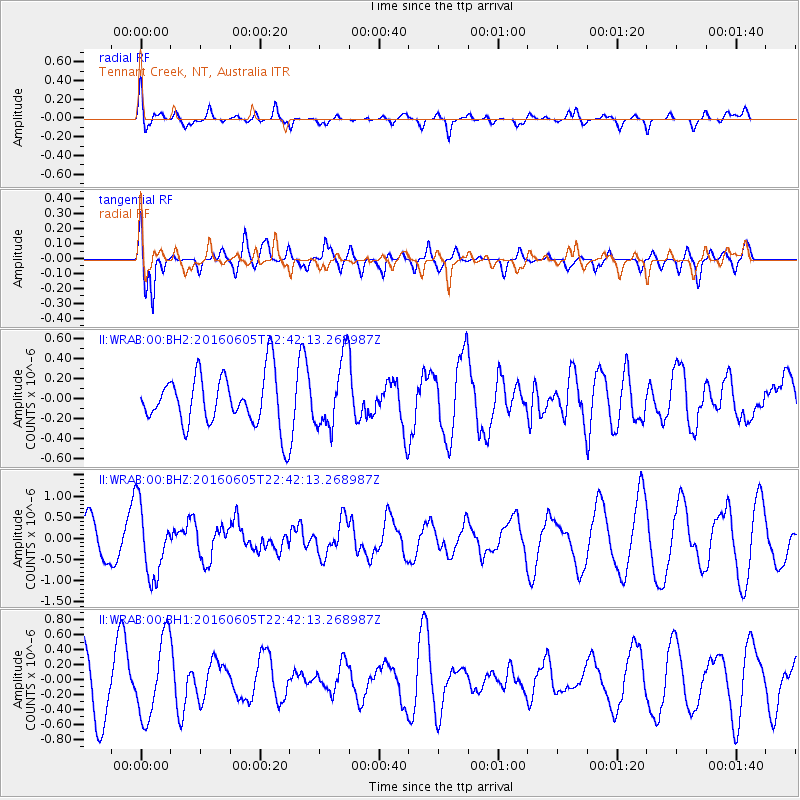
WRAB Tennant Creek, NT, Australia - Earthquake Result Viewer
*The percent match for this event was below the threshold and hence no stack was calculated.
| Earthquake location: |
Tonga Islands Region |
| Earthquake latitude/longitude: |
-17.6/-172.6 |
| Earthquake time(UTC): |
2016/06/05 (157) 22:33:49 GMT |
| Earthquake Depth: |
10 km |
| Earthquake Magnitude: |
5.6 MWW, 5.6 MWC, 5.6 MWB |
| Earthquake Catalog/Contributor: |
NEIC PDE/NEIC COMCAT |
|
| Network: |
II Global Seismograph Network (GSN - IRIS/IDA) |
| Station: |
WRAB Tennant Creek, NT, Australia |
| Lat/Lon: |
19.93 S/134.36 E |
| Elevation: |
366 m |
|
| Distance: |
50.1 deg |
| Az: |
258.521 deg |
| Baz: |
96.668 deg |
| Ray Param: |
$rayparam |
*The percent match for this event was below the threshold and hence was not used in the summary stack. |
|
| Radial Match: |
40.9323 % |
| Radial Bump: |
400 |
| Transverse Match: |
79.631996 % |
| Transverse Bump: |
400 |
| SOD ConfigId: |
1634031 |
| Insert Time: |
2016-07-02 18:52:49.277 +0000 |
| GWidth: |
2.5 |
| Max Bumps: |
400 |
| Tol: |
0.001 |
|
Signal To Noise
| Channel | StoN | STA | LTA |
| II:WRAB:00:BHZ:20160605T22:42:13.268987Z | 2.1910706 | 8.198057E-7 | 3.741576E-7 |
| II:WRAB:00:BH1:20160605T22:42:13.268987Z | 1.8831586 | 5.3120635E-7 | 2.8208265E-7 |
| II:WRAB:00:BH2:20160605T22:42:13.268987Z | 1.3285533 | 3.4550442E-7 | 2.6006063E-7 |
| Arrivals |
| Ps | |
| PpPs | |
| PsPs/PpSs | |


