You are here: Home > Network List > US - United States National Seismic Network Stations List
> Station EGMT Eagleton, Montana, USA > Earthquake Result Viewer
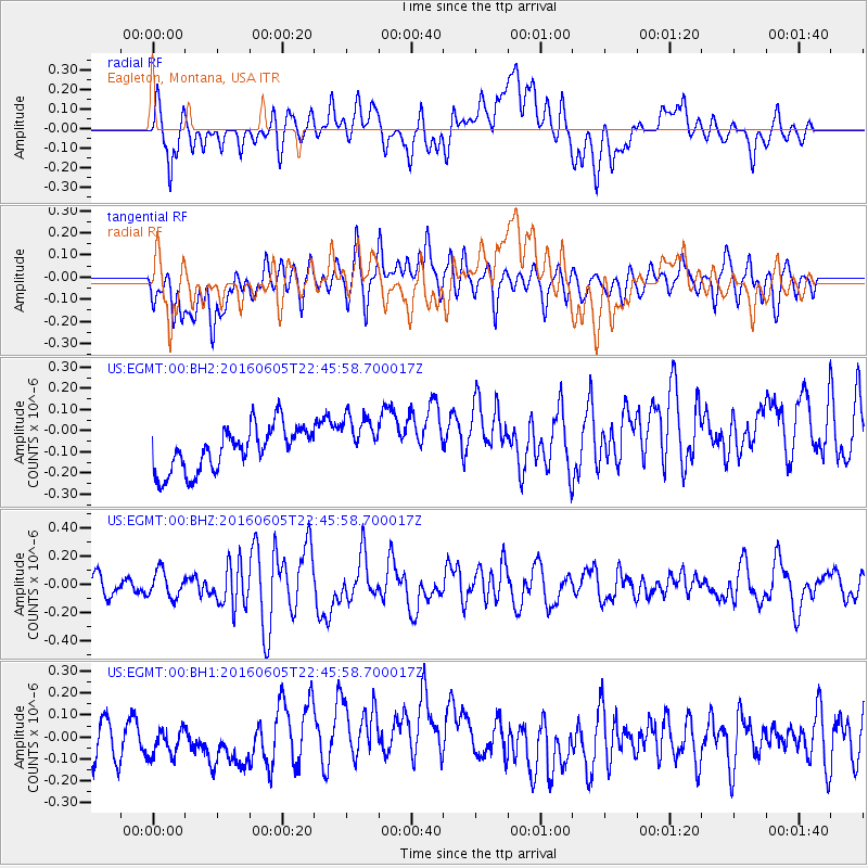
EGMT Eagleton, Montana, USA - Earthquake Result Viewer
*The percent match for this event was below the threshold and hence no stack was calculated.
| Earthquake location: |
Tonga Islands Region |
| Earthquake latitude/longitude: |
-17.6/-172.6 |
| Earthquake time(UTC): |
2016/06/05 (157) 22:33:49 GMT |
| Earthquake Depth: |
10 km |
| Earthquake Magnitude: |
5.6 MWW, 5.6 MWC, 5.6 MWB |
| Earthquake Catalog/Contributor: |
NEIC PDE/NEIC COMCAT |
|
| Network: |
US United States National Seismic Network |
| Station: |
EGMT Eagleton, Montana, USA |
| Lat/Lon: |
48.02 N/109.75 W |
| Elevation: |
1055 m |
|
| Distance: |
86.1 deg |
| Az: |
36.79 deg |
| Baz: |
238.284 deg |
| Ray Param: |
$rayparam |
*The percent match for this event was below the threshold and hence was not used in the summary stack. |
|
| Radial Match: |
58.027298 % |
| Radial Bump: |
400 |
| Transverse Match: |
52.781693 % |
| Transverse Bump: |
400 |
| SOD ConfigId: |
1634031 |
| Insert Time: |
2016-07-02 18:54:46.093 +0000 |
| GWidth: |
2.5 |
| Max Bumps: |
400 |
| Tol: |
0.001 |
|
Signal To Noise
| Channel | StoN | STA | LTA |
| US:EGMT:00:BHZ:20160605T22:45:58.700017Z | 1.6771023 | 9.356759E-8 | 5.5791226E-8 |
| US:EGMT:00:BH1:20160605T22:45:58.700017Z | 0.6245701 | 6.078013E-8 | 9.731515E-8 |
| US:EGMT:00:BH2:20160605T22:45:58.700017Z | 1.1925893 | 1.2440813E-7 | 1.04317664E-7 |
| Arrivals |
| Ps | |
| PpPs | |
| PsPs/PpSs | |


