You are here: Home > Network List > CI - Caltech Regional Seismic Network Stations List
> Station LRL Laurel Mtn Radio Fac, Ridgecrest, CA, USA > Earthquake Result Viewer
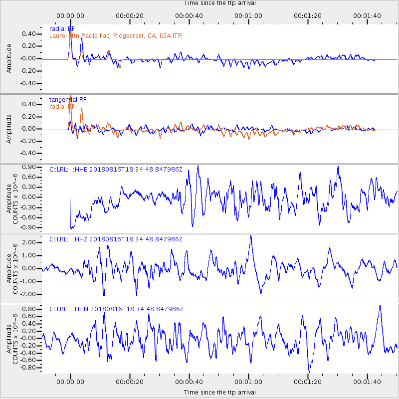
LRL Laurel Mtn Radio Fac, Ridgecrest, CA, USA - Earthquake Result Viewer
*The percent match for this event was below the threshold and hence no stack was calculated.
| Earthquake location: |
Volcano Islands, Japan Region |
| Earthquake latitude/longitude: |
23.4/143.3 |
| Earthquake time(UTC): |
2018/08/16 (228) 18:22:53 GMT |
| Earthquake Depth: |
20 km |
| Earthquake Magnitude: |
6.3 Mww |
| Earthquake Catalog/Contributor: |
NEIC PDE/us |
|
| Network: |
CI Caltech Regional Seismic Network |
| Station: |
LRL Laurel Mtn Radio Fac, Ridgecrest, CA, USA |
| Lat/Lon: |
35.48 N/117.68 W |
| Elevation: |
1340 m |
|
| Distance: |
83.6 deg |
| Az: |
54.207 deg |
| Baz: |
294.102 deg |
| Ray Param: |
$rayparam |
*The percent match for this event was below the threshold and hence was not used in the summary stack. |
|
| Radial Match: |
79.05012 % |
| Radial Bump: |
400 |
| Transverse Match: |
66.149216 % |
| Transverse Bump: |
400 |
| SOD ConfigId: |
13570011 |
| Insert Time: |
2019-04-30 19:52:21.732 +0000 |
| GWidth: |
2.5 |
| Max Bumps: |
400 |
| Tol: |
0.001 |
|
Signal To Noise
| Channel | StoN | STA | LTA |
| CI:LRL: :HHZ:20180816T18:34:48.847986Z | 1.2147236 | 3.0763547E-7 | 2.5325554E-7 |
| CI:LRL: :HHN:20180816T18:34:48.847986Z | 1.1843873 | 1.7586291E-7 | 1.4848429E-7 |
| CI:LRL: :HHE:20180816T18:34:48.847986Z | 0.82184374 | 2.6146546E-7 | 3.1814494E-7 |
| Arrivals |
| Ps | |
| PpPs | |
| PsPs/PpSs | |


