You are here: Home > Network List > TA - USArray Transportable Network (new EarthScope stations) Stations List
> Station S24A Houchin Ranch, La Veta, CO, USA > Earthquake Result Viewer
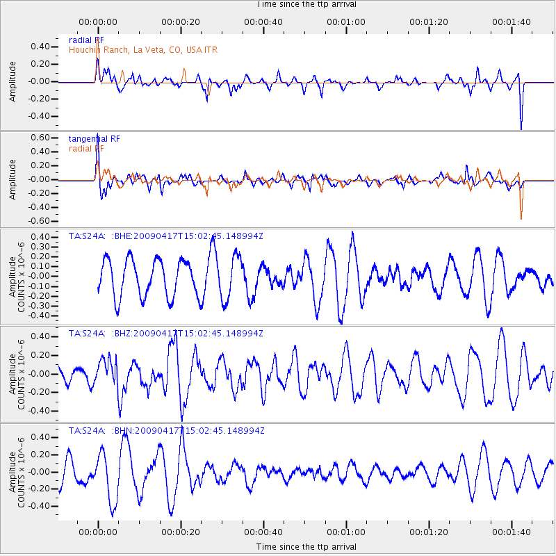
S24A Houchin Ranch, La Veta, CO, USA - Earthquake Result Viewer
*The percent match for this event was below the threshold and hence no stack was calculated.
| Earthquake location: |
Kuril Islands |
| Earthquake latitude/longitude: |
46.2/151.7 |
| Earthquake time(UTC): |
2009/04/17 (107) 14:51:58 GMT |
| Earthquake Depth: |
49 km |
| Earthquake Magnitude: |
5.5 MB, 5.0 MS, 5.7 MW, 5.6 MW |
| Earthquake Catalog/Contributor: |
WHDF/NEIC |
|
| Network: |
TA USArray Transportable Network (new EarthScope stations) |
| Station: |
S24A Houchin Ranch, La Veta, CO, USA |
| Lat/Lon: |
37.64 N/105.21 W |
| Elevation: |
2672 m |
|
| Distance: |
71.8 deg |
| Az: |
54.485 deg |
| Baz: |
314.554 deg |
| Ray Param: |
$rayparam |
*The percent match for this event was below the threshold and hence was not used in the summary stack. |
|
| Radial Match: |
44.557835 % |
| Radial Bump: |
400 |
| Transverse Match: |
61.153797 % |
| Transverse Bump: |
400 |
| SOD ConfigId: |
2658 |
| Insert Time: |
2010-03-06 13:58:10.351 +0000 |
| GWidth: |
2.5 |
| Max Bumps: |
400 |
| Tol: |
0.001 |
|
Signal To Noise
| Channel | StoN | STA | LTA |
| TA:S24A: :BHZ:20090417T15:02:45.148994Z | 0.8254013 | 1.3985274E-7 | 1.6943606E-7 |
| TA:S24A: :BHN:20090417T15:02:45.148994Z | 2.7396834 | 2.9333623E-7 | 1.070694E-7 |
| TA:S24A: :BHE:20090417T15:02:45.148994Z | 1.1787018 | 2.1716123E-7 | 1.8423763E-7 |
| Arrivals |
| Ps | |
| PpPs | |
| PsPs/PpSs | |


