You are here: Home > Network List > CI - Caltech Regional Seismic Network Stations List
> Station BFS Mt Baldy Forest Station > Earthquake Result Viewer
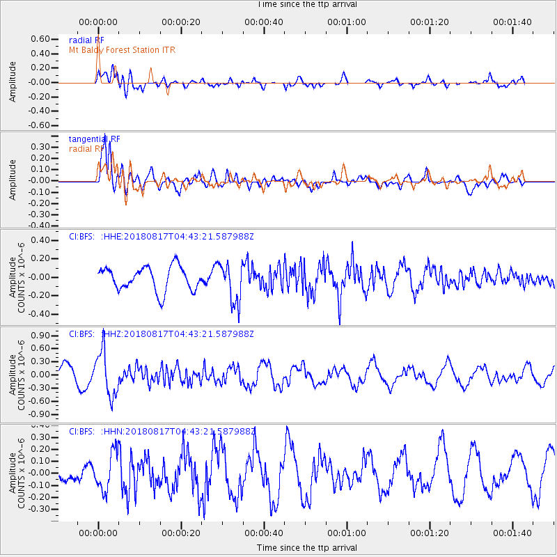
BFS Mt Baldy Forest Station - Earthquake Result Viewer
*The percent match for this event was below the threshold and hence no stack was calculated.
| Earthquake location: |
Andreanof Islands, Aleutian Is. |
| Earthquake latitude/longitude: |
51.3/-178.2 |
| Earthquake time(UTC): |
2018/08/17 (229) 04:35:29 GMT |
| Earthquake Depth: |
25 km |
| Earthquake Magnitude: |
5.8 Ml |
| Earthquake Catalog/Contributor: |
NEIC PDE/us |
|
| Network: |
CI Caltech Regional Seismic Network |
| Station: |
BFS Mt Baldy Forest Station |
| Lat/Lon: |
34.24 N/117.66 W |
| Elevation: |
1312 m |
|
| Distance: |
46.2 deg |
| Az: |
87.316 deg |
| Baz: |
310.856 deg |
| Ray Param: |
$rayparam |
*The percent match for this event was below the threshold and hence was not used in the summary stack. |
|
| Radial Match: |
33.537918 % |
| Radial Bump: |
400 |
| Transverse Match: |
82.924515 % |
| Transverse Bump: |
400 |
| SOD ConfigId: |
13570011 |
| Insert Time: |
2019-04-30 19:55:21.689 +0000 |
| GWidth: |
2.5 |
| Max Bumps: |
400 |
| Tol: |
0.001 |
|
Signal To Noise
| Channel | StoN | STA | LTA |
| CI:BFS: :HHZ:20180817T04:43:21.587988Z | 2.7499275 | 5.183825E-7 | 1.885077E-7 |
| CI:BFS: :HHN:20180817T04:43:21.587988Z | 1.5863787 | 1.6243486E-7 | 1.0239349E-7 |
| CI:BFS: :HHE:20180817T04:43:21.587988Z | 1.6814663 | 2.1548767E-7 | 1.2815462E-7 |
| Arrivals |
| Ps | |
| PpPs | |
| PsPs/PpSs | |


