You are here: Home > Network List > CI - Caltech Regional Seismic Network Stations List
> Station MPM Manuel Prospect Mine, California, USA > Earthquake Result Viewer
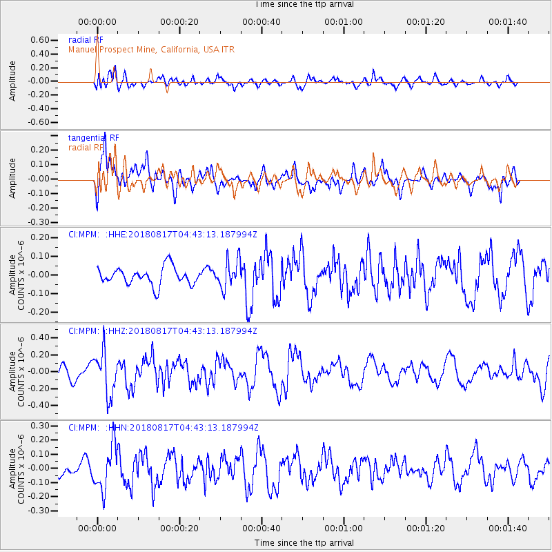
MPM Manuel Prospect Mine, California, USA - Earthquake Result Viewer
*The percent match for this event was below the threshold and hence no stack was calculated.
| Earthquake location: |
Andreanof Islands, Aleutian Is. |
| Earthquake latitude/longitude: |
51.3/-178.2 |
| Earthquake time(UTC): |
2018/08/17 (229) 04:35:29 GMT |
| Earthquake Depth: |
25 km |
| Earthquake Magnitude: |
5.8 Ml |
| Earthquake Catalog/Contributor: |
NEIC PDE/us |
|
| Network: |
CI Caltech Regional Seismic Network |
| Station: |
MPM Manuel Prospect Mine, California, USA |
| Lat/Lon: |
36.06 N/117.49 W |
| Elevation: |
185 m |
|
| Distance: |
45.2 deg |
| Az: |
85.253 deg |
| Baz: |
309.511 deg |
| Ray Param: |
$rayparam |
*The percent match for this event was below the threshold and hence was not used in the summary stack. |
|
| Radial Match: |
59.213345 % |
| Radial Bump: |
400 |
| Transverse Match: |
60.421272 % |
| Transverse Bump: |
400 |
| SOD ConfigId: |
13570011 |
| Insert Time: |
2019-04-30 19:55:40.334 +0000 |
| GWidth: |
2.5 |
| Max Bumps: |
400 |
| Tol: |
0.001 |
|
Signal To Noise
| Channel | StoN | STA | LTA |
| CI:MPM: :HHZ:20180817T04:43:13.187994Z | 2.535778 | 2.590671E-7 | 1.0216474E-7 |
| CI:MPM: :HHN:20180817T04:43:13.187994Z | 1.2133548 | 1.606298E-7 | 1.3238486E-7 |
| CI:MPM: :HHE:20180817T04:43:13.187994Z | 1.6327838 | 7.710739E-8 | 4.7224493E-8 |
| Arrivals |
| Ps | |
| PpPs | |
| PsPs/PpSs | |


