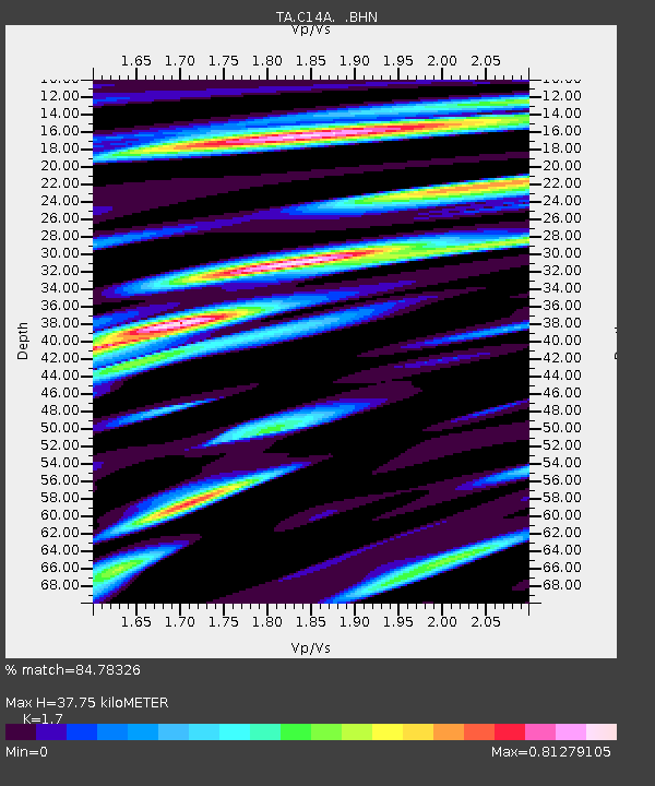
C14A Swan Lake, MT, USA - Earthquake Result Viewer

Earthquake location: Rat Islands, Aleutian Islands
Earthquake latitude/longitude: 51.3/179.0
Earthquake time(UTC): 2008/07/25 (207) 00:29:22 GMT
Earthquake Depth: 21 km
Earthquake Magnitude: 5.7 MB, 5.5 MS, 5.9 MW, 5.9 MW
Earthquake Catalog/Contributor: WHDF/NEIC
Network: TA USArray Transportable Network (new EarthScope stations)
Station: C14A Swan Lake, MT, USA
Lat/Lon: 47.77 N/113.75 W
Elevation: 1173 m
Distance: 42.4 deg
Az: 67.257 deg
Baz: 300.833 deg
Ray Param: 0.07315312
Estimated Moho Depth: 37.75 km
Estimated Crust Vp/Vs: 1.70
Assumed Crust Vp: 6.353 km/s
Estimated Crust Vs: 3.737 km/s
Estimated Crust Poisson's Ratio: 0.24
Radial Match: 84.78326 %
Radial Bump: 399
Transverse Match: 75.7631 %
Transverse Bump: 400
SOD ConfigId: 2504
Insert Time: 2010-03-06 13:59:37.362 +0000
GWidth: 2.5
Max Bumps: 400
Tol: 0.001

Signal To Noise

ChannelStoNSTALTA
TA:C14A: :BHN:20080725T00:36:45.325011Z7.2021415.038541E-76.9958936E-8
TA:C14A: :BHE:20080725T00:36:45.325011Z4.6346561.5225446E-73.2851297E-8
TA:C14A: :BHZ:20080725T00:36:45.325011Z6.85423563.121719E-74.5544375E-8
Arrivals
Ps4.5 SECOND
PpPs15 SECOND
PsPs/PpSs19 SECOND