You are here: Home > Network List > TA - USArray Transportable Network (new EarthScope stations) Stations List
> Station 435B Jarrell, TX, USA > Earthquake Result Viewer
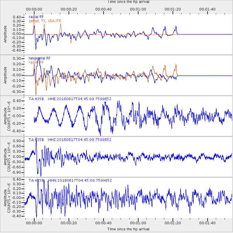
435B Jarrell, TX, USA - Earthquake Result Viewer
*The percent match for this event was below the threshold and hence no stack was calculated.
| Earthquake location: |
Andreanof Islands, Aleutian Is. |
| Earthquake latitude/longitude: |
51.3/-178.2 |
| Earthquake time(UTC): |
2018/08/17 (229) 04:35:29 GMT |
| Earthquake Depth: |
25 km |
| Earthquake Magnitude: |
5.8 Ml |
| Earthquake Catalog/Contributor: |
NEIC PDE/us |
|
| Network: |
TA USArray Transportable Network (new EarthScope stations) |
| Station: |
435B Jarrell, TX, USA |
| Lat/Lon: |
30.78 N/97.58 W |
| Elevation: |
248 m |
|
| Distance: |
61.0 deg |
| Az: |
76.114 deg |
| Baz: |
314.961 deg |
| Ray Param: |
$rayparam |
*The percent match for this event was below the threshold and hence was not used in the summary stack. |
|
| Radial Match: |
59.87466 % |
| Radial Bump: |
400 |
| Transverse Match: |
65.71841 % |
| Transverse Bump: |
400 |
| SOD ConfigId: |
13570011 |
| Insert Time: |
2019-04-30 20:03:26.465 +0000 |
| GWidth: |
2.5 |
| Max Bumps: |
400 |
| Tol: |
0.001 |
|
Signal To Noise
| Channel | StoN | STA | LTA |
| TA:435B: :HHZ:20180817T04:45:09.759985Z | 3.0592332 | 5.583266E-7 | 1.825054E-7 |
| TA:435B: :HHN:20180817T04:45:09.759985Z | 2.4704654 | 1.8252388E-7 | 7.388238E-8 |
| TA:435B: :HHE:20180817T04:45:09.759985Z | 1.4060669 | 2.0157711E-7 | 1.4336239E-7 |
| Arrivals |
| Ps | |
| PpPs | |
| PsPs/PpSs | |


