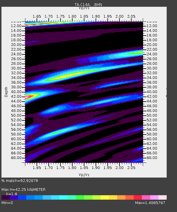
C14A Swan Lake, MT, USA - Earthquake Result Viewer
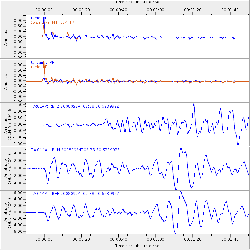
Earthquake location: Off Coast Of Jalisco, Mexico
Earthquake latitude/longitude: 17.6/-105.5
Earthquake time(UTC): 2008/09/24 (268) 02:33:05 GMT
Earthquake Depth: 10 km
Earthquake Magnitude: 5.7 MB, 6.2 MS, 6.4 MW, 6.4 MW
Earthquake Catalog/Contributor: WHDF/NEIC
Network: TA USArray Transportable Network (new EarthScope stations)
Station: C14A Swan Lake, MT, USA
Lat/Lon: 47.77 N/113.75 W
Elevation: 1173 m
Distance: 30.8 deg
Az: 349.118 deg
Baz: 164.519 deg
Ray Param: 0.07922835
Estimated Moho Depth: 42.25 km
Estimated Crust Vp/Vs: 1.60
Assumed Crust Vp: 6.353 km/s
Estimated Crust Vs: 3.971 km/s
Estimated Crust Poisson's Ratio: 0.18
Radial Match: 92.92879 %
Radial Bump: 263
Transverse Match: 69.239235 %
Transverse Bump: 400
SOD ConfigId: 2560
Insert Time: 2010-03-06 13:59:55.575 +0000
GWidth: 2.5
Max Bumps: 400
Tol: 0.001

Signal To Noise

ChannelStoNSTALTA
TA:C14A: :BHN:20080924T02:38:50.623992Z20.7582441.8903147E-69.106333E-8
TA:C14A: :BHE:20080924T02:38:50.623992Z12.7752211.2985521E-61.0164616E-7
TA:C14A: :BHZ:20080924T02:38:50.623992Z3.69063882.4727782E-76.700136E-8
Arrivals
Ps4.4 SECOND
PpPs16 SECOND
PsPs/PpSs20 SECOND