C14A Swan Lake, MT, USA - Earthquake Result Viewer
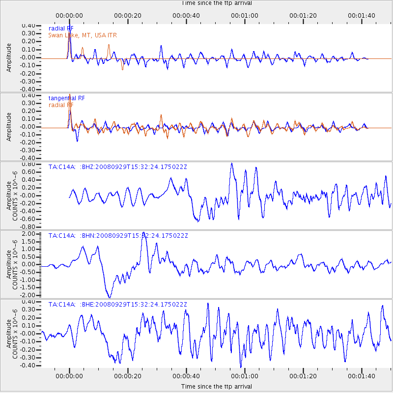
Earthquake location: Kermadec Islands, New Zealand
Earthquake latitude/longitude: -29.8/-177.7
Earthquake time(UTC): 2008/09/29 (273) 15:19:31 GMT
Earthquake Depth: 36 km
Earthquake Magnitude: 6.5 MB, 6.7 MS, 7.0 MW, 7.0 MW
Earthquake Catalog/Contributor: WHDF/NEIC
Network: TA USArray Transportable Network (new EarthScope stations)
Station: C14A Swan Lake, MT, USA
Lat/Lon: 47.77 N/113.75 W
Elevation: 1173 m
Distance: 96.1 deg
Az: 37.552 deg
Baz: 231.78 deg
Ray Param: 0.040582225
Estimated Moho Depth: 52.25 km
Estimated Crust Vp/Vs: 2.07
Assumed Crust Vp: 6.353 km/s
Estimated Crust Vs: 3.077 km/s
Estimated Crust Poisson's Ratio: 0.35
Radial Match: 86.73309 %
Radial Bump: 400
Transverse Match: 68.853355 %
Transverse Bump: 400
SOD ConfigId: 2560
Insert Time: 2010-03-06 13:59:57.708 +0000
GWidth: 2.5
Max Bumps: 400
Tol: 0.001

Signal To Noise

ChannelStoNSTALTA
TA:C14A: :BHN:20080929T15:32:24.175022Z7.64001375.854039E-77.66234E-8
TA:C14A: :BHE:20080929T15:32:24.175022Z1.49270361.3961638E-79.3532556E-8
TA:C14A: :BHZ:20080929T15:32:24.175022Z1.43969211.852404E-71.2866667E-7
Arrivals
Ps8.9 SECOND
PpPs25 SECOND
PsPs/PpSs34 SECOND