You are here: Home > Network List > UW - Pacific Northwest Regional Seismic Network Stations List
> Station LEBA Lebam, WA, USA > Earthquake Result Viewer
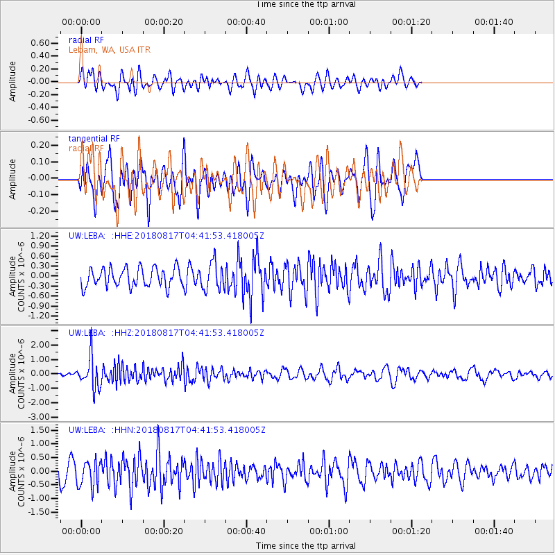
LEBA Lebam, WA, USA - Earthquake Result Viewer
*The percent match for this event was below the threshold and hence no stack was calculated.
| Earthquake location: |
Andreanof Islands, Aleutian Is. |
| Earthquake latitude/longitude: |
51.3/-178.2 |
| Earthquake time(UTC): |
2018/08/17 (229) 04:35:29 GMT |
| Earthquake Depth: |
25 km |
| Earthquake Magnitude: |
5.8 Ml |
| Earthquake Catalog/Contributor: |
NEIC PDE/us |
|
| Network: |
UW Pacific Northwest Regional Seismic Network |
| Station: |
LEBA Lebam, WA, USA |
| Lat/Lon: |
46.55 N/123.56 W |
| Elevation: |
73 m |
|
| Distance: |
35.5 deg |
| Az: |
75.774 deg |
| Baz: |
298.239 deg |
| Ray Param: |
$rayparam |
*The percent match for this event was below the threshold and hence was not used in the summary stack. |
|
| Radial Match: |
52.336956 % |
| Radial Bump: |
400 |
| Transverse Match: |
68.88666 % |
| Transverse Bump: |
400 |
| SOD ConfigId: |
13570011 |
| Insert Time: |
2019-04-30 20:04:52.249 +0000 |
| GWidth: |
2.5 |
| Max Bumps: |
400 |
| Tol: |
0.001 |
|
Signal To Noise
| Channel | StoN | STA | LTA |
| UW:LEBA: :HHZ:20180817T04:41:53.418005Z | 5.549674 | 1.0836127E-6 | 1.95257E-7 |
| UW:LEBA: :HHN:20180817T04:41:53.418005Z | 1.7338331 | 4.847988E-7 | 2.7961102E-7 |
| UW:LEBA: :HHE:20180817T04:41:53.418005Z | 1.4863826 | 4.0983522E-7 | 2.757266E-7 |
| Arrivals |
| Ps | |
| PpPs | |
| PsPs/PpSs | |


