You are here: Home > Network List > UW - Pacific Northwest Regional Seismic Network Stations List
> Station LEBA Lebam, WA, USA > Earthquake Result Viewer
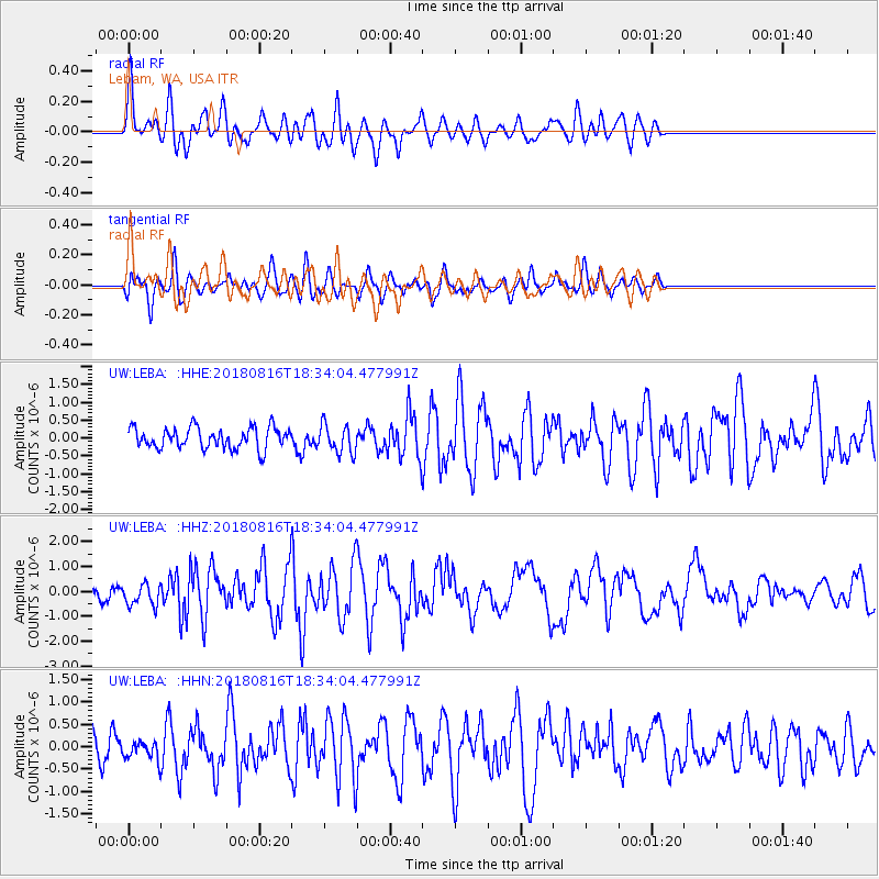
LEBA Lebam, WA, USA - Earthquake Result Viewer
*The percent match for this event was below the threshold and hence no stack was calculated.
| Earthquake location: |
Volcano Islands, Japan Region |
| Earthquake latitude/longitude: |
23.4/143.3 |
| Earthquake time(UTC): |
2018/08/16 (228) 18:22:53 GMT |
| Earthquake Depth: |
20 km |
| Earthquake Magnitude: |
6.3 Mww |
| Earthquake Catalog/Contributor: |
NEIC PDE/us |
|
| Network: |
UW Pacific Northwest Regional Seismic Network |
| Station: |
LEBA Lebam, WA, USA |
| Lat/Lon: |
46.55 N/123.56 W |
| Elevation: |
73 m |
|
| Distance: |
75.4 deg |
| Az: |
45.406 deg |
| Baz: |
288.629 deg |
| Ray Param: |
$rayparam |
*The percent match for this event was below the threshold and hence was not used in the summary stack. |
|
| Radial Match: |
75.397415 % |
| Radial Bump: |
400 |
| Transverse Match: |
65.82491 % |
| Transverse Bump: |
400 |
| SOD ConfigId: |
13570011 |
| Insert Time: |
2019-04-30 20:09:00.393 +0000 |
| GWidth: |
2.5 |
| Max Bumps: |
400 |
| Tol: |
0.001 |
|
Signal To Noise
| Channel | StoN | STA | LTA |
| UW:LEBA: :HHZ:20180816T18:34:04.477991Z | 1.4125745 | 4.4312523E-7 | 3.137004E-7 |
| UW:LEBA: :HHN:20180816T18:34:04.477991Z | 0.7660896 | 2.1427832E-7 | 2.7970398E-7 |
| UW:LEBA: :HHE:20180816T18:34:04.477991Z | 1.3706065 | 3.998857E-7 | 2.917582E-7 |
| Arrivals |
| Ps | |
| PpPs | |
| PsPs/PpSs | |


