You are here: Home > Network List > AV - Alaska Volcano Observatory Stations List
> Station AMKA Regional Station, Amchitka Island, Alaska > Earthquake Result Viewer
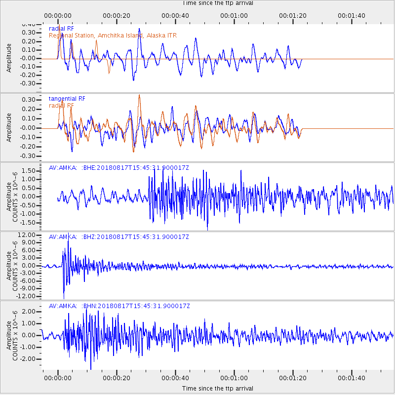
AMKA Regional Station, Amchitka Island, Alaska - Earthquake Result Viewer
*The percent match for this event was below the threshold and hence no stack was calculated.
| Earthquake location: |
Flores Sea |
| Earthquake latitude/longitude: |
-7.4/119.8 |
| Earthquake time(UTC): |
2018/08/17 (229) 15:35:02 GMT |
| Earthquake Depth: |
539 km |
| Earthquake Magnitude: |
6.5 Mww |
| Earthquake Catalog/Contributor: |
NEIC PDE/us |
|
| Network: |
AV Alaska Volcano Observatory |
| Station: |
AMKA Regional Station, Amchitka Island, Alaska |
| Lat/Lon: |
51.38 N/179.30 E |
| Elevation: |
116 m |
|
| Distance: |
77.5 deg |
| Az: |
33.569 deg |
| Baz: |
241.042 deg |
| Ray Param: |
$rayparam |
*The percent match for this event was below the threshold and hence was not used in the summary stack. |
|
| Radial Match: |
64.003 % |
| Radial Bump: |
400 |
| Transverse Match: |
66.072685 % |
| Transverse Bump: |
400 |
| SOD ConfigId: |
13570011 |
| Insert Time: |
2019-04-30 20:10:46.534 +0000 |
| GWidth: |
2.5 |
| Max Bumps: |
400 |
| Tol: |
0.001 |
|
Signal To Noise
| Channel | StoN | STA | LTA |
| AV:AMKA: :BHZ:20180817T15:45:31.900017Z | 17.644491 | 4.4250432E-6 | 2.5078896E-7 |
| AV:AMKA: :BHN:20180817T15:45:31.900017Z | 2.9053752 | 5.979386E-7 | 2.0580427E-7 |
| AV:AMKA: :BHE:20180817T15:45:31.900017Z | 2.3841405 | 6.258266E-7 | 2.624957E-7 |
| Arrivals |
| Ps | |
| PpPs | |
| PsPs/PpSs | |


