You are here: Home > Network List > AV - Alaska Volcano Observatory Stations List
> Station MAPS Pakushin Southeast, Makushin Volcano, Alaska > Earthquake Result Viewer
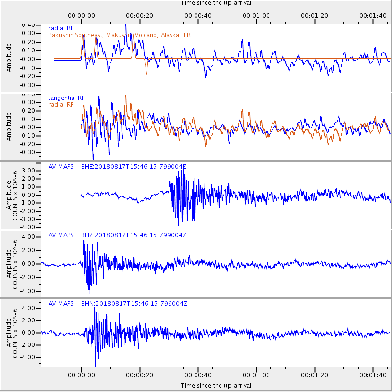
MAPS Pakushin Southeast, Makushin Volcano, Alaska - Earthquake Result Viewer
*The percent match for this event was below the threshold and hence no stack was calculated.
| Earthquake location: |
Flores Sea |
| Earthquake latitude/longitude: |
-7.4/119.8 |
| Earthquake time(UTC): |
2018/08/17 (229) 15:35:02 GMT |
| Earthquake Depth: |
539 km |
| Earthquake Magnitude: |
6.5 Mww |
| Earthquake Catalog/Contributor: |
NEIC PDE/us |
|
| Network: |
AV Alaska Volcano Observatory |
| Station: |
MAPS Pakushin Southeast, Makushin Volcano, Alaska |
| Lat/Lon: |
53.81 N/166.94 W |
| Elevation: |
333 m |
|
| Distance: |
86.2 deg |
| Az: |
34.69 deg |
| Baz: |
252.124 deg |
| Ray Param: |
$rayparam |
*The percent match for this event was below the threshold and hence was not used in the summary stack. |
|
| Radial Match: |
66.22144 % |
| Radial Bump: |
400 |
| Transverse Match: |
63.6928 % |
| Transverse Bump: |
400 |
| SOD ConfigId: |
13570011 |
| Insert Time: |
2019-04-30 20:10:56.122 +0000 |
| GWidth: |
2.5 |
| Max Bumps: |
400 |
| Tol: |
0.001 |
|
Signal To Noise
| Channel | StoN | STA | LTA |
| AV:MAPS: :BHZ:20180817T15:46:15.799004Z | 12.602503 | 1.8586635E-6 | 1.4748368E-7 |
| AV:MAPS: :BHN:20180817T15:46:15.799004Z | 7.1827736 | 1.2732703E-6 | 1.7726722E-7 |
| AV:MAPS: :BHE:20180817T15:46:15.799004Z | 4.3028736 | 1.4569993E-6 | 3.3861073E-7 |
| Arrivals |
| Ps | |
| PpPs | |
| PsPs/PpSs | |


