You are here: Home > Network List > AV - Alaska Volcano Observatory Stations List
> Station SPU Mount Spurr, Mount Spurr, Alaska > Earthquake Result Viewer
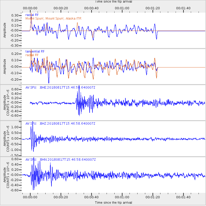
SPU Mount Spurr, Mount Spurr, Alaska - Earthquake Result Viewer
*The percent match for this event was below the threshold and hence no stack was calculated.
| Earthquake location: |
Flores Sea |
| Earthquake latitude/longitude: |
-7.4/119.8 |
| Earthquake time(UTC): |
2018/08/17 (229) 15:35:02 GMT |
| Earthquake Depth: |
539 km |
| Earthquake Magnitude: |
6.5 Mww |
| Earthquake Catalog/Contributor: |
NEIC PDE/us |
|
| Network: |
AV Alaska Volcano Observatory |
| Station: |
SPU Mount Spurr, Mount Spurr, Alaska |
| Lat/Lon: |
61.18 N/152.06 W |
| Elevation: |
800 m |
|
| Distance: |
95.5 deg |
| Az: |
29.113 deg |
| Baz: |
264.783 deg |
| Ray Param: |
$rayparam |
*The percent match for this event was below the threshold and hence was not used in the summary stack. |
|
| Radial Match: |
71.52654 % |
| Radial Bump: |
400 |
| Transverse Match: |
68.137596 % |
| Transverse Bump: |
400 |
| SOD ConfigId: |
13570011 |
| Insert Time: |
2019-04-30 20:11:17.663 +0000 |
| GWidth: |
2.5 |
| Max Bumps: |
400 |
| Tol: |
0.001 |
|
Signal To Noise
| Channel | StoN | STA | LTA |
| AV:SPU: :BHZ:20180817T15:46:58.640007Z | 22.461176 | 5.6371744E-7 | 2.5097414E-8 |
| AV:SPU: :BHN:20180817T15:46:58.640007Z | 7.904675 | 2.5178983E-7 | 3.185328E-8 |
| AV:SPU: :BHE:20180817T15:46:58.640007Z | 10.096511 | 2.5845716E-7 | 2.5598663E-8 |
| Arrivals |
| Ps | |
| PpPs | |
| PsPs/PpSs | |


