
C14A Swan Lake, MT, USA - Earthquake Result Viewer
| ||||||||||||||||||
| ||||||||||||||||||
| ||||||||||||||||||
|
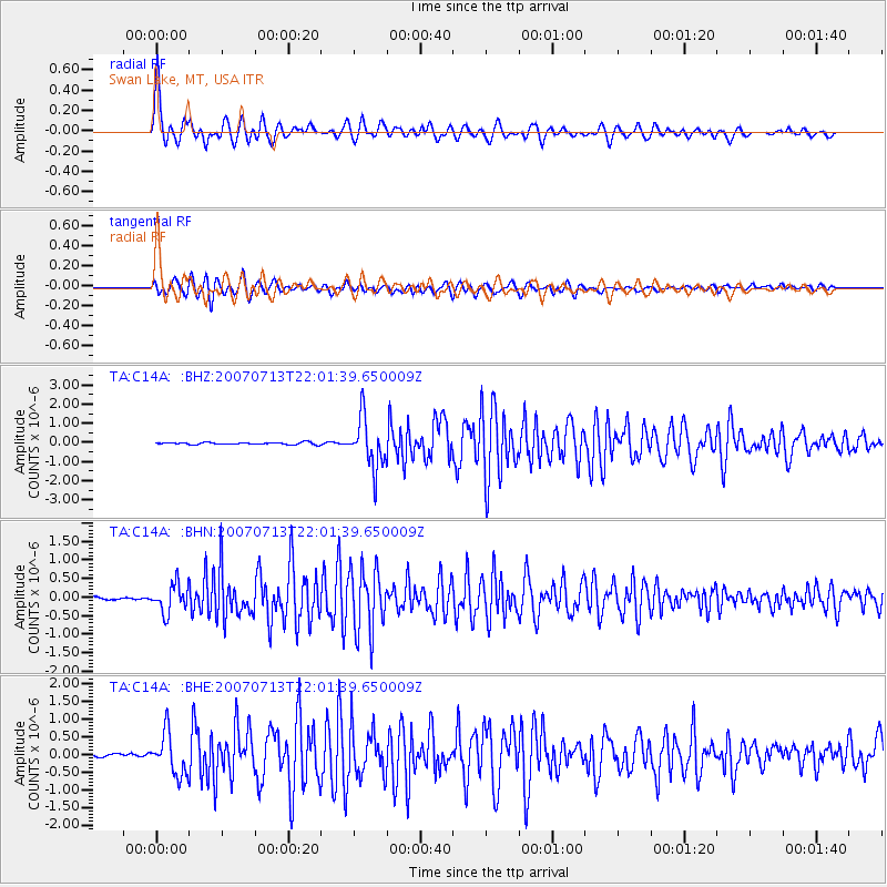
Signal To Noise
| Channel | StoN | STA | LTA |
| TA:C14A: :BHN:20070713T22:01:39.650009Z | 8.639384 | 3.7647885E-7 | 4.3577046E-8 |
| TA:C14A: :BHE:20070713T22:01:39.650009Z | 13.527306 | 5.8481197E-7 | 4.3231964E-8 |
| TA:C14A: :BHZ:20070713T22:01:39.650009Z | 24.580112 | 1.2977748E-6 | 5.279776E-8 |
| Arrivals | |
| Ps | 4.4 SECOND |
| PpPs | 13 SECOND |
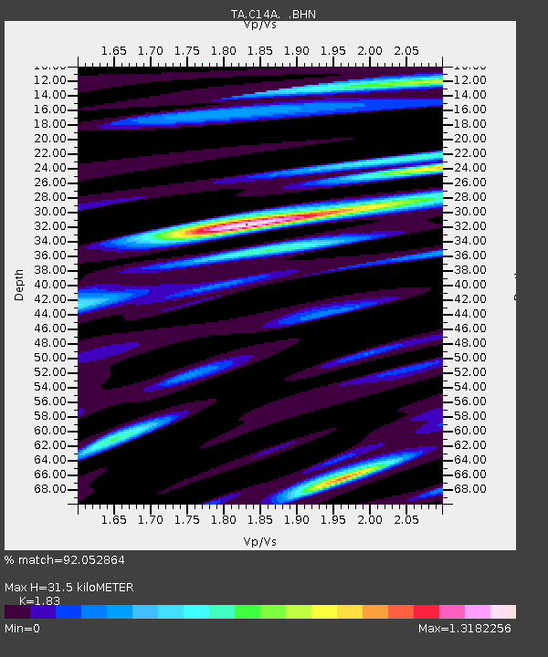
| PsPs/PpSs | 18 SECOND |

