C14A Swan Lake, MT, USA - Earthquake Result Viewer
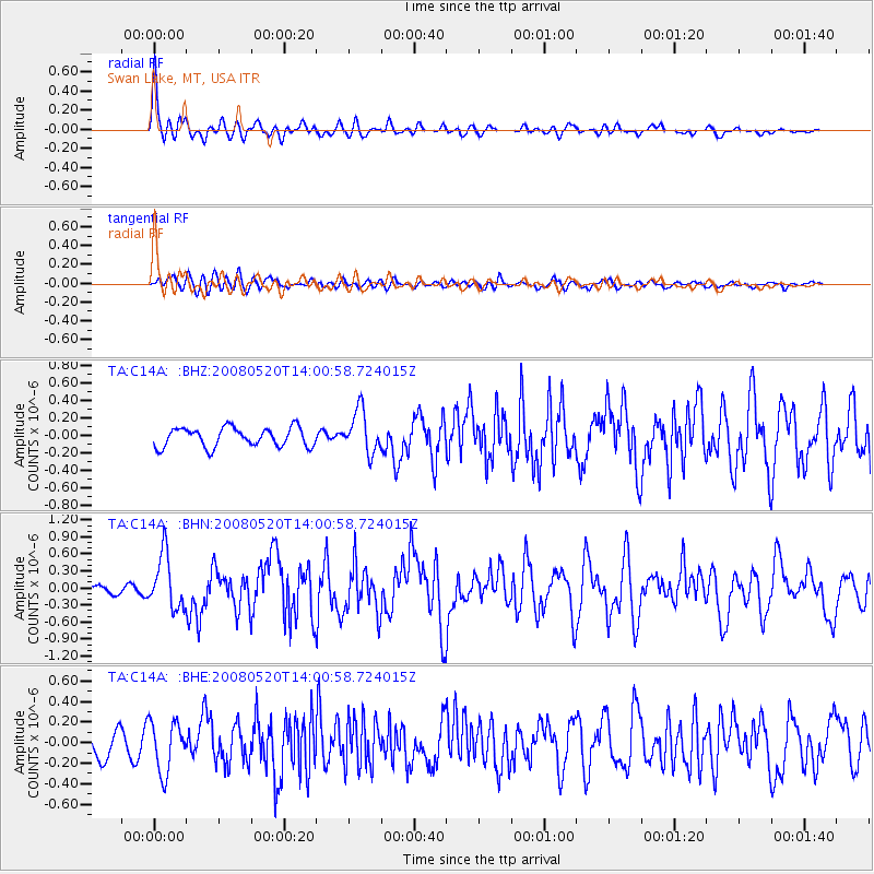
Earthquake location: Rat Islands, Aleutian Islands
Earthquake latitude/longitude: 51.2/178.8
Earthquake time(UTC): 2008/05/20 (141) 13:53:35 GMT
Earthquake Depth: 27 km
Earthquake Magnitude: 5.8 MB, 6.0 MS, 6.3 MW, 6.3 MW
Earthquake Catalog/Contributor: WHDF/NEIC
Network: TA USArray Transportable Network (new EarthScope stations)
Station: C14A Swan Lake, MT, USA
Lat/Lon: 47.77 N/113.75 W
Elevation: 1173 m
Distance: 42.6 deg
Az: 67.025 deg
Baz: 300.754 deg
Ray Param: 0.07303319
Estimated Moho Depth: 41.0 km
Estimated Crust Vp/Vs: 1.60
Assumed Crust Vp: 6.353 km/s
Estimated Crust Vs: 3.971 km/s
Estimated Crust Poisson's Ratio: 0.18
Radial Match: 83.882484 %
Radial Bump: 400
Transverse Match: 67.03917 %
Transverse Bump: 400
SOD ConfigId: 2504
Insert Time: 2010-03-06 14:02:11.291 +0000
GWidth: 2.5
Max Bumps: 400
Tol: 0.001

Signal To Noise

ChannelStoNSTALTA
TA:C14A: :BHN:20080520T14:00:58.724015Z3.77333744.778638E-71.2664222E-7
TA:C14A: :BHE:20080520T14:00:58.724015Z2.11072.46506E-71.1678875E-7
TA:C14A: :BHZ:20080520T14:00:58.724015Z2.21426772.4351039E-71.0997333E-7
Arrivals
Ps4.2 SECOND
PpPs16 SECOND
PsPs/PpSs20 SECOND