You are here: Home > Network List > CI - Caltech Regional Seismic Network Stations List
> Station SWS Sam W. Stewart, Westmorland, CA, USA > Earthquake Result Viewer
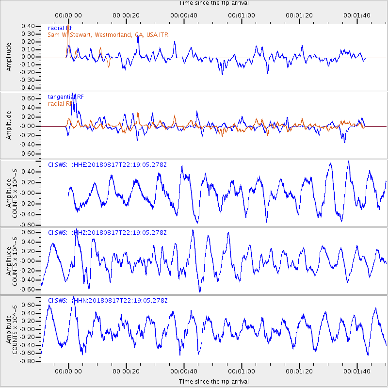
SWS Sam W. Stewart, Westmorland, CA, USA - Earthquake Result Viewer
*The percent match for this event was below the threshold and hence no stack was calculated.
| Earthquake location: |
Volcano Islands, Japan Region |
| Earthquake latitude/longitude: |
23.5/143.3 |
| Earthquake time(UTC): |
2018/08/17 (229) 22:06:57 GMT |
| Earthquake Depth: |
18 km |
| Earthquake Magnitude: |
5.5 Mww |
| Earthquake Catalog/Contributor: |
NEIC PDE/us |
|
| Network: |
CI Caltech Regional Seismic Network |
| Station: |
SWS Sam W. Stewart, Westmorland, CA, USA |
| Lat/Lon: |
32.94 N/115.80 W |
| Elevation: |
140 m |
|
| Distance: |
86.0 deg |
| Az: |
55.875 deg |
| Baz: |
295.325 deg |
| Ray Param: |
$rayparam |
*The percent match for this event was below the threshold and hence was not used in the summary stack. |
|
| Radial Match: |
81.72424 % |
| Radial Bump: |
400 |
| Transverse Match: |
83.02339 % |
| Transverse Bump: |
322 |
| SOD ConfigId: |
13570011 |
| Insert Time: |
2019-04-30 20:18:38.814 +0000 |
| GWidth: |
2.5 |
| Max Bumps: |
400 |
| Tol: |
0.001 |
|
Signal To Noise
| Channel | StoN | STA | LTA |
| CI:SWS: :HHZ:20180817T22:19:05.278Z | 1.4947866 | 3.2348015E-7 | 2.1640557E-7 |
| CI:SWS: :HHN:20180817T22:19:05.278Z | 1.5132402 | 4.4555574E-7 | 2.9443822E-7 |
| CI:SWS: :HHE:20180817T22:19:05.278Z | 1.251241 | 2.1023486E-7 | 1.6802107E-7 |
| Arrivals |
| Ps | |
| PpPs | |
| PsPs/PpSs | |


