You are here: Home > Network List > TA - USArray Transportable Network (new EarthScope stations) Stations List
> Station E20K Nigu River, AK, USA > Earthquake Result Viewer
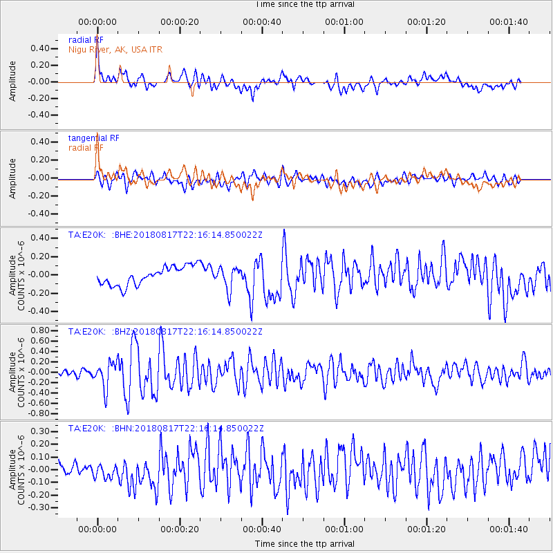
E20K Nigu River, AK, USA - Earthquake Result Viewer
*The percent match for this event was below the threshold and hence no stack was calculated.
| Earthquake location: |
Volcano Islands, Japan Region |
| Earthquake latitude/longitude: |
23.5/143.3 |
| Earthquake time(UTC): |
2018/08/17 (229) 22:06:57 GMT |
| Earthquake Depth: |
18 km |
| Earthquake Magnitude: |
5.5 Mww |
| Earthquake Catalog/Contributor: |
NEIC PDE/us |
|
| Network: |
TA USArray Transportable Network (new EarthScope stations) |
| Station: |
E20K Nigu River, AK, USA |
| Lat/Lon: |
68.26 N/156.19 W |
| Elevation: |
866 m |
|
| Distance: |
57.6 deg |
| Az: |
22.586 deg |
| Baz: |
251.17 deg |
| Ray Param: |
$rayparam |
*The percent match for this event was below the threshold and hence was not used in the summary stack. |
|
| Radial Match: |
62.03321 % |
| Radial Bump: |
400 |
| Transverse Match: |
67.881546 % |
| Transverse Bump: |
400 |
| SOD ConfigId: |
13570011 |
| Insert Time: |
2019-04-30 20:22:20.083 +0000 |
| GWidth: |
2.5 |
| Max Bumps: |
400 |
| Tol: |
0.001 |
|
Signal To Noise
| Channel | StoN | STA | LTA |
| TA:E20K: :BHZ:20180817T22:16:14.850022Z | 4.9970007 | 2.57794E-7 | 5.158975E-8 |
| TA:E20K: :BHN:20180817T22:16:14.850022Z | 0.8259785 | 6.098946E-8 | 7.383904E-8 |
| TA:E20K: :BHE:20180817T22:16:14.850022Z | 1.2342389 | 1.2441352E-7 | 1.0080182E-7 |
| Arrivals |
| Ps | |
| PpPs | |
| PsPs/PpSs | |


