You are here: Home > Network List > TA - USArray Transportable Network (new EarthScope stations) Stations List
> Station F21K Alatna River, AK, USA > Earthquake Result Viewer
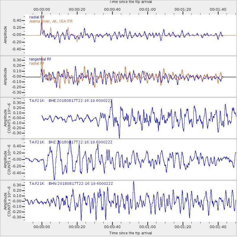
F21K Alatna River, AK, USA - Earthquake Result Viewer
*The percent match for this event was below the threshold and hence no stack was calculated.
| Earthquake location: |
Volcano Islands, Japan Region |
| Earthquake latitude/longitude: |
23.5/143.3 |
| Earthquake time(UTC): |
2018/08/17 (229) 22:06:57 GMT |
| Earthquake Depth: |
18 km |
| Earthquake Magnitude: |
5.5 Mww |
| Earthquake Catalog/Contributor: |
NEIC PDE/us |
|
| Network: |
TA USArray Transportable Network (new EarthScope stations) |
| Station: |
F21K Alatna River, AK, USA |
| Lat/Lon: |
67.22 N/153.48 W |
| Elevation: |
597 m |
|
| Distance: |
58.2 deg |
| Az: |
24.118 deg |
| Baz: |
254.485 deg |
| Ray Param: |
$rayparam |
*The percent match for this event was below the threshold and hence was not used in the summary stack. |
|
| Radial Match: |
70.79266 % |
| Radial Bump: |
400 |
| Transverse Match: |
71.44067 % |
| Transverse Bump: |
400 |
| SOD ConfigId: |
13570011 |
| Insert Time: |
2019-04-30 20:22:29.133 +0000 |
| GWidth: |
2.5 |
| Max Bumps: |
400 |
| Tol: |
0.001 |
|
Signal To Noise
| Channel | StoN | STA | LTA |
| TA:F21K: :BHZ:20180817T22:16:19.600022Z | 4.6826 | 1.7866445E-7 | 3.815497E-8 |
| TA:F21K: :BHN:20180817T22:16:19.600022Z | 0.90328276 | 3.13013E-8 | 3.4652825E-8 |
| TA:F21K: :BHE:20180817T22:16:19.600022Z | 2.0136552 | 7.1433824E-8 | 3.5474702E-8 |
| Arrivals |
| Ps | |
| PpPs | |
| PsPs/PpSs | |


