You are here: Home > Network List > TA - USArray Transportable Network (new EarthScope stations) Stations List
> Station M16K Timber Creek, AK, USA > Earthquake Result Viewer
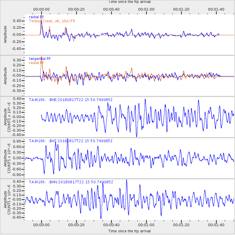
M16K Timber Creek, AK, USA - Earthquake Result Viewer
*The percent match for this event was below the threshold and hence no stack was calculated.
| Earthquake location: |
Volcano Islands, Japan Region |
| Earthquake latitude/longitude: |
23.5/143.3 |
| Earthquake time(UTC): |
2018/08/17 (229) 22:06:57 GMT |
| Earthquake Depth: |
18 km |
| Earthquake Magnitude: |
5.5 Mww |
| Earthquake Catalog/Contributor: |
NEIC PDE/us |
|
| Network: |
TA USArray Transportable Network (new EarthScope stations) |
| Station: |
M16K Timber Creek, AK, USA |
| Lat/Lon: |
61.02 N/158.96 W |
| Elevation: |
394 m |
|
| Distance: |
54.2 deg |
| Az: |
30.495 deg |
| Baz: |
253.107 deg |
| Ray Param: |
$rayparam |
*The percent match for this event was below the threshold and hence was not used in the summary stack. |
|
| Radial Match: |
72.45101 % |
| Radial Bump: |
400 |
| Transverse Match: |
74.18827 % |
| Transverse Bump: |
400 |
| SOD ConfigId: |
13570011 |
| Insert Time: |
2019-04-30 20:23:21.050 +0000 |
| GWidth: |
2.5 |
| Max Bumps: |
400 |
| Tol: |
0.001 |
|
Signal To Noise
| Channel | StoN | STA | LTA |
| TA:M16K: :BHZ:20180817T22:15:50.749985Z | 7.1415987 | 3.390652E-7 | 4.7477492E-8 |
| TA:M16K: :BHN:20180817T22:15:50.749985Z | 1.3375239 | 7.417067E-8 | 5.5453718E-8 |
| TA:M16K: :BHE:20180817T22:15:50.749985Z | 2.2944658 | 1.5200597E-7 | 6.624896E-8 |
| Arrivals |
| Ps | |
| PpPs | |
| PsPs/PpSs | |


