You are here: Home > Network List > TA - USArray Transportable Network (new EarthScope stations) Stations List
> Station Q24A Divide, CO, USA > Earthquake Result Viewer
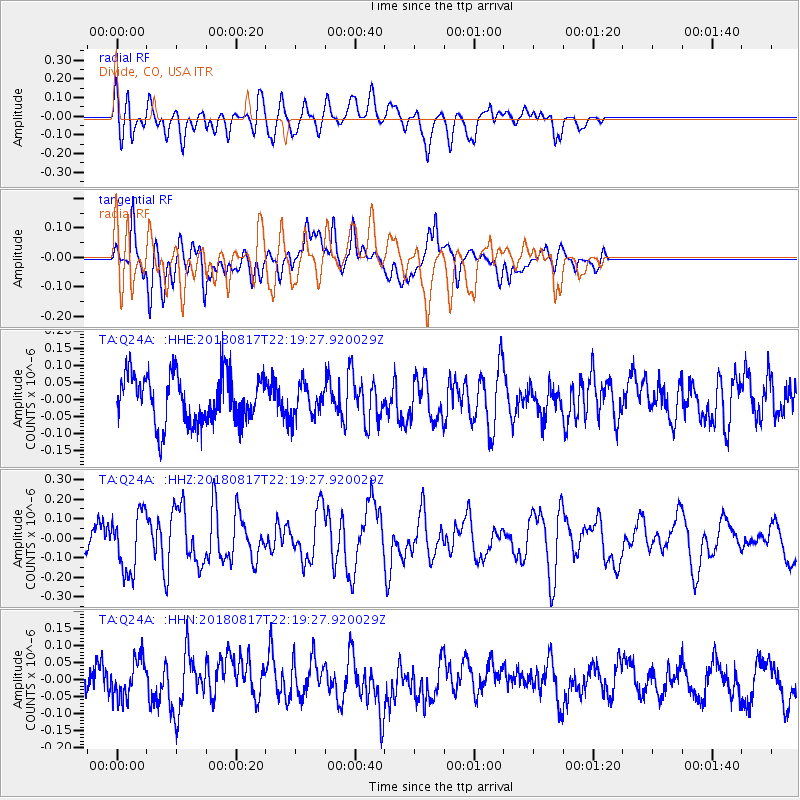
Q24A Divide, CO, USA - Earthquake Result Viewer
*The percent match for this event was below the threshold and hence no stack was calculated.
| Earthquake location: |
Volcano Islands, Japan Region |
| Earthquake latitude/longitude: |
23.5/143.3 |
| Earthquake time(UTC): |
2018/08/17 (229) 22:06:57 GMT |
| Earthquake Depth: |
18 km |
| Earthquake Magnitude: |
5.5 Mww |
| Earthquake Catalog/Contributor: |
NEIC PDE/us |
|
| Network: |
TA USArray Transportable Network (new EarthScope stations) |
| Station: |
Q24A Divide, CO, USA |
| Lat/Lon: |
38.96 N/105.15 W |
| Elevation: |
2775 m |
|
| Distance: |
90.8 deg |
| Az: |
46.503 deg |
| Baz: |
301.312 deg |
| Ray Param: |
$rayparam |
*The percent match for this event was below the threshold and hence was not used in the summary stack. |
|
| Radial Match: |
58.057888 % |
| Radial Bump: |
400 |
| Transverse Match: |
67.93002 % |
| Transverse Bump: |
400 |
| SOD ConfigId: |
13570011 |
| Insert Time: |
2019-04-30 20:23:53.463 +0000 |
| GWidth: |
2.5 |
| Max Bumps: |
400 |
| Tol: |
0.001 |
|
Signal To Noise
| Channel | StoN | STA | LTA |
| TA:Q24A: :HHZ:20180817T22:19:27.920029Z | 1.8112587 | 1.4996277E-7 | 8.2794784E-8 |
| TA:Q24A: :HHN:20180817T22:19:27.920029Z | 1.1325291 | 5.7581413E-8 | 5.0843205E-8 |
| TA:Q24A: :HHE:20180817T22:19:27.920029Z | 0.6592716 | 4.6533856E-8 | 7.0583745E-8 |
| Arrivals |
| Ps | |
| PpPs | |
| PsPs/PpSs | |


