You are here: Home > Network List > UW - Pacific Northwest Regional Seismic Network Stations List
> Station LEBA Lebam, WA, USA > Earthquake Result Viewer
LEBA Lebam, WA, USA - Earthquake Result Viewer
*The percent match for this event was below the threshold and hence no stack was calculated.
| Earthquake location: |
Volcano Islands, Japan Region |
| Earthquake latitude/longitude: |
23.5/143.3 |
| Earthquake time(UTC): |
2018/08/17 (229) 22:06:57 GMT |
| Earthquake Depth: |
18 km |
| Earthquake Magnitude: |
5.5 Mww |
| Earthquake Catalog/Contributor: |
NEIC PDE/us |
|
| Network: |
UW Pacific Northwest Regional Seismic Network |
| Station: |
LEBA Lebam, WA, USA |
| Lat/Lon: |
46.55 N/123.56 W |
| Elevation: |
73 m |
|
| Distance: |
75.4 deg |
| Az: |
45.421 deg |
| Baz: |
288.639 deg |
| Ray Param: |
$rayparam |
*The percent match for this event was below the threshold and hence was not used in the summary stack. |
|
| Radial Match: |
50.882214 % |
| Radial Bump: |
400 |
| Transverse Match: |
47.65725 % |
| Transverse Bump: |
400 |
| SOD ConfigId: |
13570011 |
| Insert Time: |
2019-04-30 20:24:56.696 +0000 |
| GWidth: |
2.5 |
| Max Bumps: |
400 |
| Tol: |
0.001 |
|
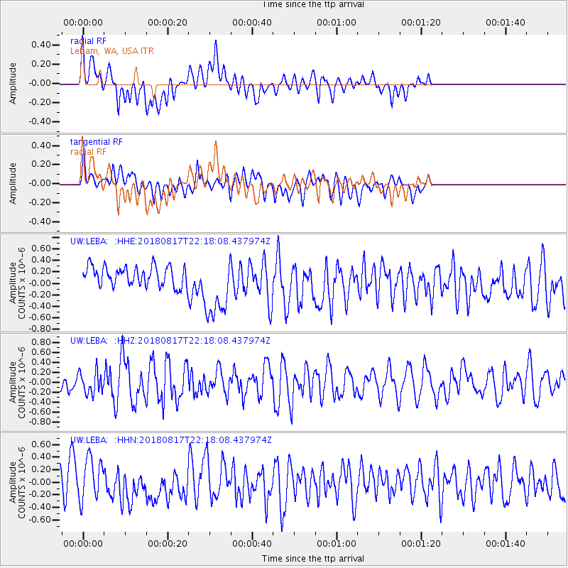
Signal To Noise
| Channel | StoN | STA | LTA |
| UW:LEBA: :HHZ:20180817T22:18:08.437974Z | 0.7143854 | 2.1369304E-7 | 2.9912854E-7 |
| UW:LEBA: :HHN:20180817T22:18:08.437974Z | 1.3877246 | 3.3091942E-7 | 2.3846187E-7 |
| UW:LEBA: :HHE:20180817T22:18:08.437974Z | 3.479436 | 5.792088E-7 | 1.664663E-7 |
| Arrivals |
| Ps | |
| PpPs | |
| PsPs/PpSs | |


