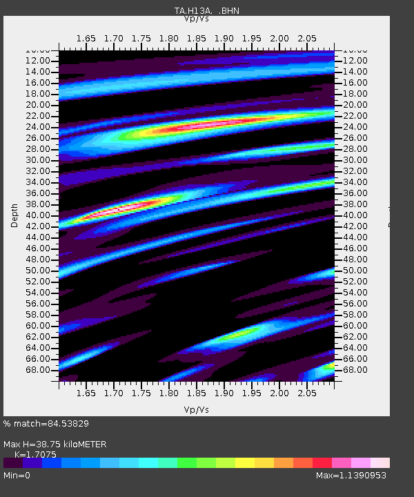
H13A Challis, ID, USA - Earthquake Result Viewer
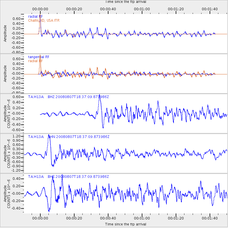
Earthquake location: Andreanof Islands, Aleutian Is.
Earthquake latitude/longitude: 52.2/-175.7
Earthquake time(UTC): 2008/08/07 (220) 18:30:03 GMT
Earthquake Depth: 12 km
Earthquake Magnitude: 5.6 MB, 5.5 MS, 5.8 MW, 5.8 MW
Earthquake Catalog/Contributor: WHDF/NEIC
Network: TA USArray Transportable Network (new EarthScope stations)
Station: H13A Challis, ID, USA
Lat/Lon: 44.56 N/114.25 W
Elevation: 1563 m
Distance: 40.4 deg
Az: 75.627 deg
Baz: 303.461 deg
Ray Param: 0.07442922
Estimated Moho Depth: 38.75 km
Estimated Crust Vp/Vs: 1.71
Assumed Crust Vp: 6.577 km/s
Estimated Crust Vs: 3.852 km/s
Estimated Crust Poisson's Ratio: 0.24
Radial Match: 84.53829 %
Radial Bump: 400
Transverse Match: 71.97372 %
Transverse Bump: 400
SOD ConfigId: 2504
Insert Time: 2010-03-06 14:04:59.073 +0000
GWidth: 2.5
Max Bumps: 400
Tol: 0.001

Signal To Noise

ChannelStoNSTALTA
TA:H13A: :BHN:20080807T18:37:09.873986Z7.38458543.5674034E-74.8308788E-8
TA:H13A: :BHE:20080807T18:37:09.873986Z5.0517591.4195615E-72.8100343E-8
TA:H13A: :BHZ:20080807T18:37:09.873986Z5.26098781.8545438E-73.5250867E-8
Arrivals
Ps4.5 SECOND
PpPs15 SECOND
PsPs/PpSs19 SECOND