You are here: Home > Network List > US - United States National Seismic Network Stations List
> Station HAWA Hanford, Washington, USA > Earthquake Result Viewer
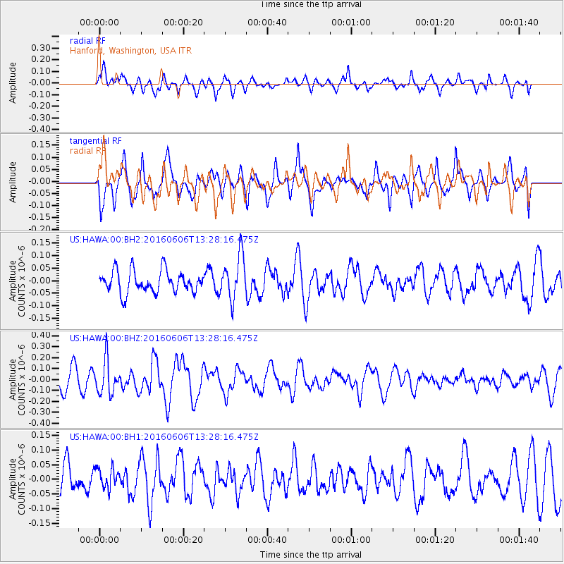
HAWA Hanford, Washington, USA - Earthquake Result Viewer
*The percent match for this event was below the threshold and hence no stack was calculated.
| Earthquake location: |
Near Coast Of Central Chile |
| Earthquake latitude/longitude: |
-30.1/-71.5 |
| Earthquake time(UTC): |
2016/06/06 (158) 13:16:02 GMT |
| Earthquake Depth: |
30 km |
| Earthquake Magnitude: |
5.5 MWW, 5.4 MWB |
| Earthquake Catalog/Contributor: |
NEIC PDE/NEIC COMCAT |
|
| Network: |
US United States National Seismic Network |
| Station: |
HAWA Hanford, Washington, USA |
| Lat/Lon: |
46.39 N/119.53 W |
| Elevation: |
364 m |
|
| Distance: |
87.6 deg |
| Az: |
328.977 deg |
| Baz: |
139.79 deg |
| Ray Param: |
$rayparam |
*The percent match for this event was below the threshold and hence was not used in the summary stack. |
|
| Radial Match: |
61.917416 % |
| Radial Bump: |
400 |
| Transverse Match: |
51.00864 % |
| Transverse Bump: |
400 |
| SOD ConfigId: |
1634031 |
| Insert Time: |
2016-07-03 15:13:47.877 +0000 |
| GWidth: |
2.5 |
| Max Bumps: |
400 |
| Tol: |
0.001 |
|
Signal To Noise
| Channel | StoN | STA | LTA |
| US:HAWA:00:BHZ:20160606T13:28:16.475Z | 2.04778 | 1.5591799E-7 | 7.6140005E-8 |
| US:HAWA:00:BH1:20160606T13:28:16.475Z | 0.5928448 | 3.3890558E-8 | 5.716599E-8 |
| US:HAWA:00:BH2:20160606T13:28:16.475Z | 2.0797176 | 9.040177E-8 | 4.346829E-8 |
| Arrivals |
| Ps | |
| PpPs | |
| PsPs/PpSs | |


