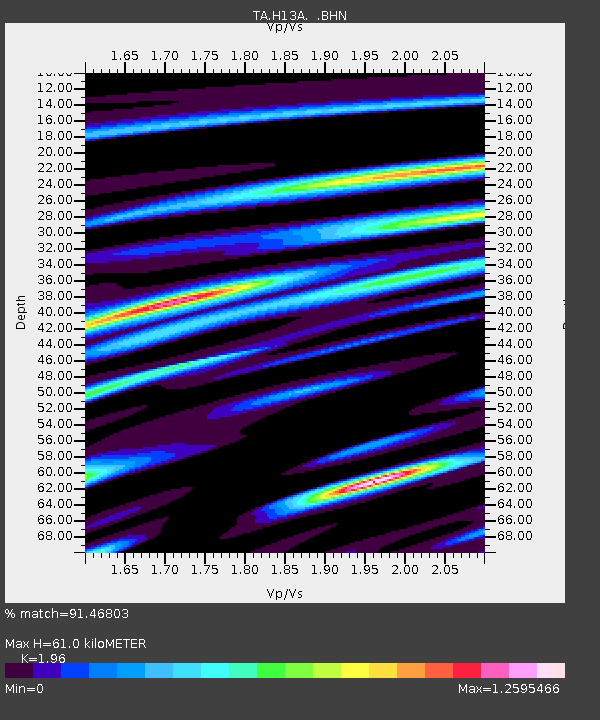
H13A Challis, ID, USA - Earthquake Result Viewer
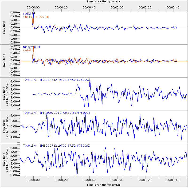
Earthquake location: Andreanof Islands, Aleutian Is.
Earthquake latitude/longitude: 51.4/-179.5
Earthquake time(UTC): 2007/12/19 (353) 09:30:27 GMT
Earthquake Depth: 29 km
Earthquake Magnitude: 6.4 MB, 7.1 MS, 7.1 MW, 7.0 MW
Earthquake Catalog/Contributor: WHDF/NEIC
Network: TA USArray Transportable Network (new EarthScope stations)
Station: H13A Challis, ID, USA
Lat/Lon: 44.56 N/114.25 W
Elevation: 1563 m
Distance: 42.9 deg
Az: 72.442 deg
Baz: 303.259 deg
Ray Param: 0.072827585
Estimated Moho Depth: 61.0 km
Estimated Crust Vp/Vs: 1.96
Assumed Crust Vp: 6.577 km/s
Estimated Crust Vs: 3.356 km/s
Estimated Crust Poisson's Ratio: 0.32
Radial Match: 91.46803 %
Radial Bump: 400
Transverse Match: 75.66602 %
Transverse Bump: 400
SOD ConfigId: 2564
Insert Time: 2010-03-06 14:05:29.433 +0000
GWidth: 2.5
Max Bumps: 400
Tol: 0.001

Signal To Noise

ChannelStoNSTALTA
TA:H13A: :BHN:20071219T09:37:52.675009Z4.07493731.166956E-62.86374E-7
TA:H13A: :BHE:20071219T09:37:52.675009Z4.23222162.2431043E-65.300064E-7
TA:H13A: :BHZ:20071219T09:37:52.675009Z8.4136683.4876196E-64.1451835E-7
Arrivals
Ps9.5 SECOND
PpPs26 SECOND
PsPs/PpSs35 SECOND