You are here: Home > Network List > US - United States National Seismic Network Stations List
> Station MSO Missoula, Montana, USA > Earthquake Result Viewer
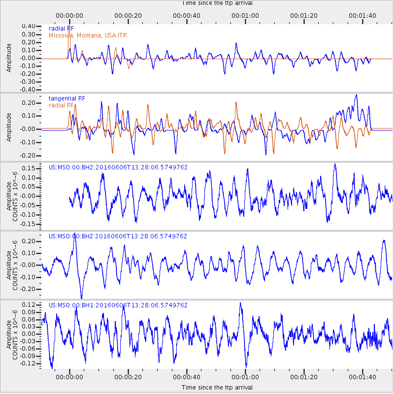
MSO Missoula, Montana, USA - Earthquake Result Viewer
*The percent match for this event was below the threshold and hence no stack was calculated.
| Earthquake location: |
Near Coast Of Central Chile |
| Earthquake latitude/longitude: |
-30.1/-71.5 |
| Earthquake time(UTC): |
2016/06/06 (158) 13:16:02 GMT |
| Earthquake Depth: |
30 km |
| Earthquake Magnitude: |
5.5 MWW, 5.4 MWB |
| Earthquake Catalog/Contributor: |
NEIC PDE/NEIC COMCAT |
|
| Network: |
US United States National Seismic Network |
| Station: |
MSO Missoula, Montana, USA |
| Lat/Lon: |
46.83 N/113.94 W |
| Elevation: |
1264 m |
|
| Distance: |
85.6 deg |
| Az: |
332.285 deg |
| Baz: |
144.038 deg |
| Ray Param: |
$rayparam |
*The percent match for this event was below the threshold and hence was not used in the summary stack. |
|
| Radial Match: |
40.717907 % |
| Radial Bump: |
400 |
| Transverse Match: |
39.80353 % |
| Transverse Bump: |
400 |
| SOD ConfigId: |
1634031 |
| Insert Time: |
2016-07-03 15:14:07.656 +0000 |
| GWidth: |
2.5 |
| Max Bumps: |
400 |
| Tol: |
0.001 |
|
Signal To Noise
| Channel | StoN | STA | LTA |
| US:MSO:00:BHZ:20160606T13:28:06.574976Z | 3.4171522 | 1.5319257E-7 | 4.483048E-8 |
| US:MSO:00:BH1:20160606T13:28:06.574976Z | 1.0706567 | 4.905854E-8 | 4.5820983E-8 |
| US:MSO:00:BH2:20160606T13:28:06.574976Z | 0.9985554 | 5.7074388E-8 | 5.7156957E-8 |
| Arrivals |
| Ps | |
| PpPs | |
| PsPs/PpSs | |


