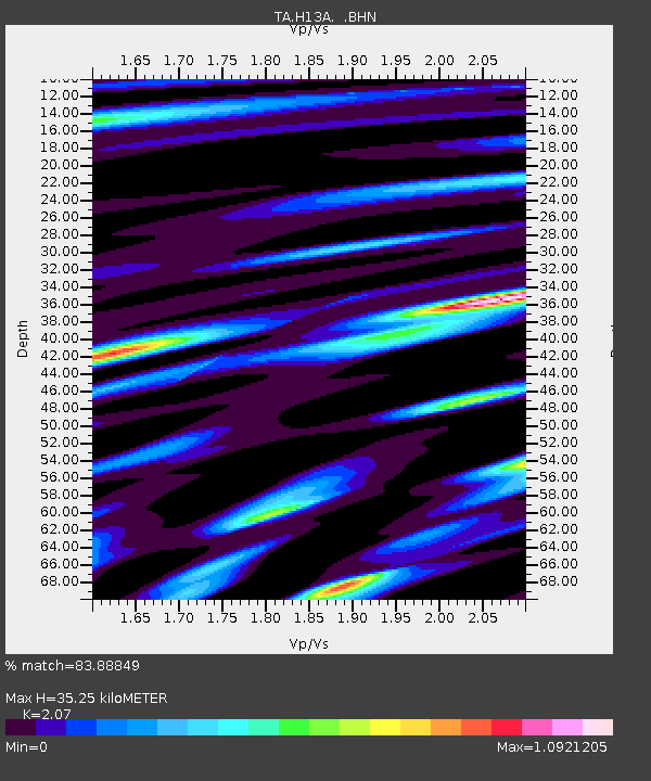
H13A Challis, ID, USA - Earthquake Result Viewer
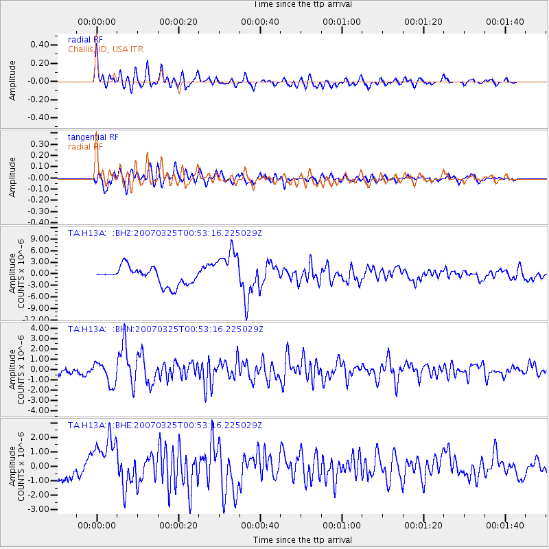
Earthquake location: Near West Coast Of Honshu, Japan
Earthquake latitude/longitude: 37.3/136.6
Earthquake time(UTC): 2007/03/25 (084) 00:41:57 GMT
Earthquake Depth: 8.0 km
Earthquake Magnitude: 6.1 MB, 6.8 MS, 6.7 MW, 6.6 MW
Earthquake Catalog/Contributor: WHDF/NEIC
Network: TA USArray Transportable Network (new EarthScope stations)
Station: H13A Challis, ID, USA
Lat/Lon: 44.56 N/114.25 W
Elevation: 1563 m
Distance: 76.4 deg
Az: 44.007 deg
Baz: 309.225 deg
Ray Param: 0.051031828
Estimated Moho Depth: 35.25 km
Estimated Crust Vp/Vs: 2.07
Assumed Crust Vp: 6.577 km/s
Estimated Crust Vs: 3.177 km/s
Estimated Crust Poisson's Ratio: 0.35
Radial Match: 83.88849 %
Radial Bump: 400
Transverse Match: 72.27421 %
Transverse Bump: 400
SOD ConfigId: 2564
Insert Time: 2010-03-06 14:06:57.191 +0000
GWidth: 2.5
Max Bumps: 400
Tol: 0.001

Signal To Noise

ChannelStoNSTALTA
TA:H13A: :BHN:20070325T00:53:16.225029Z3.47364881.0687946E-63.076864E-7
TA:H13A: :BHE:20070325T00:53:16.225029Z2.34980421.7329139E-67.374716E-7
TA:H13A: :BHZ:20070325T00:53:16.225029Z2.42753035.3880394E-62.219556E-6
Arrivals
Ps5.9 SECOND
PpPs16 SECOND
PsPs/PpSs22 SECOND