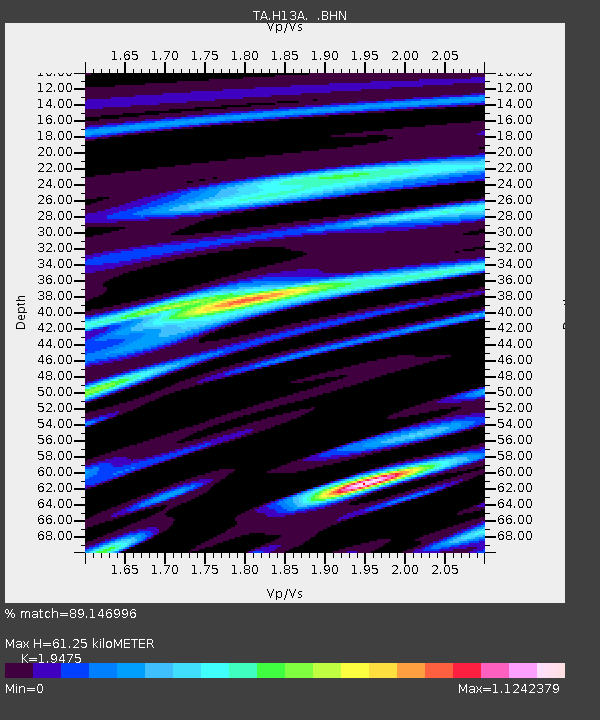
H13A Challis, ID, USA - Earthquake Result Viewer
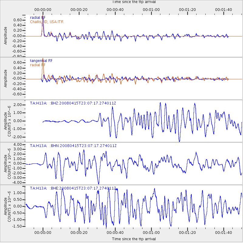
Earthquake location: Andreanof Islands, Aleutian Is.
Earthquake latitude/longitude: 51.9/-179.4
Earthquake time(UTC): 2008/04/15 (106) 22:59:51 GMT
Earthquake Depth: 10 km
Earthquake Magnitude: 6.1 MB, 6.4 MS, 6.4 MW, 6.4 MW
Earthquake Catalog/Contributor: WHDF/NEIC
Network: TA USArray Transportable Network (new EarthScope stations)
Station: H13A Challis, ID, USA
Lat/Lon: 44.56 N/114.25 W
Elevation: 1563 m
Distance: 42.7 deg
Az: 73.044 deg
Baz: 303.905 deg
Ray Param: 0.07303526
Estimated Moho Depth: 61.25 km
Estimated Crust Vp/Vs: 1.95
Assumed Crust Vp: 6.577 km/s
Estimated Crust Vs: 3.377 km/s
Estimated Crust Poisson's Ratio: 0.32
Radial Match: 89.146996 %
Radial Bump: 400
Transverse Match: 79.5914 %
Transverse Bump: 400
SOD ConfigId: 2504
Insert Time: 2010-03-06 14:07:31.050 +0000
GWidth: 2.5
Max Bumps: 400
Tol: 0.001

Signal To Noise

ChannelStoNSTALTA
TA:H13A: :BHN:20080415T23:07:17.274011Z15.8417189.424182E-75.9489647E-8
TA:H13A: :BHE:20080415T23:07:17.274011Z3.22382883.4678158E-71.0756823E-7
TA:H13A: :BHZ:20080415T23:07:17.274011Z5.18084144.14899E-78.0083325E-8
Arrivals
Ps9.4 SECOND
PpPs26 SECOND
PsPs/PpSs35 SECOND